Lagan Towpath
Lisburn to Belfast
Northern Ireland
Distance 24.5km Climb 40m
Saturday 1 February 2020
I started up in the Wallace Park and was fascinated by the drinking fountain. As I walked through the park I found myself walking into the local Saturday Parkrun.

I left the park on Park Parade and turned right. Crossing over the railway line and continued onto Queens Road where I found a subway which took me onto the banks of the River Lagan and the Lagan Towpath.
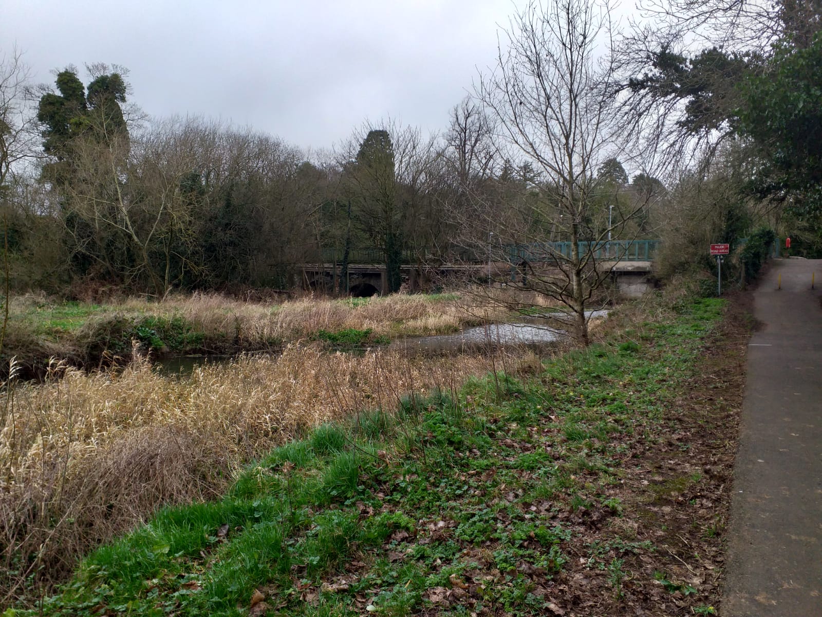
Leaving the subway I came across another of the 1000 Royal Bank of Scotland Cycleway sign posts. Follow this link to my last walk where I passed one of these signs.
Following the sign I turned towards Belfast. The distance it shows is 11.5 miles?

I passed a sign for the Diana Princess of Wales Garden. Followed Cycle Route 9 over the Millennium Bridge which took me to the Island Arts Centre. I followed Route 9 to my left onto Jubilee Bridge.


Over the bridge I climbed a few stairs to reach the Towpath. It was a little colder along here, but I would soon warm up. There was a strong wind behind me and I saw what I thought were artic terns battling against the wind. I could see the Diana Princess of Wales Garden on the far bank.

The Lagan split for a little way, it may have been to push water down towards the mill. There was a number of moorhens in the marsh grass islands in the middle of the River, along with a few footballs.

Around the bend Hilden Mill came into sight, a massive site of derelict what would have been impressive buildings. On returning home I looked up a little on Hilden Mill and it was water powered. I also saw it was originally owned by the Barbour family. There is a Barbour factory near where I live. Possibly related?
I also noticed near the mill, a number of tall wide trees stood between the River and the Towpath. They must have grown after the Towpath was no longer used by horses, I could imagine it being very inconvenient for the people using horses to pull the barges and having to manoeuvre around such large trees.

After the mill I passed a sign for Hilden Lock. The Towpath crossed a road as it twisted and turns towards Belfast.

As I approached the Tullynacross Road, movement caught my eye across the River. It was a large brown bird flying through the trees. Unfortunately I did not get a photo however it brought my attention to a grey heron standing perfectly still in the long grass. I am sorry to say that photo has not come out very clear.
After passing Lambeg Bridge the Towpath turns right slightly and runs by a high wall. My map shows a bottling plant is on the other side of the wall. The large tree in this photo was dancing in the wind. Can you see what I mean about the trees in between the River and the Towpath.

Over the River I could see a small church, my map shows this as Lambeg Parish Church.

The River and Towpath almost go around the church in a big loop. The River continues around to the left and the Towpath continues almost straight by the abandoned canal.


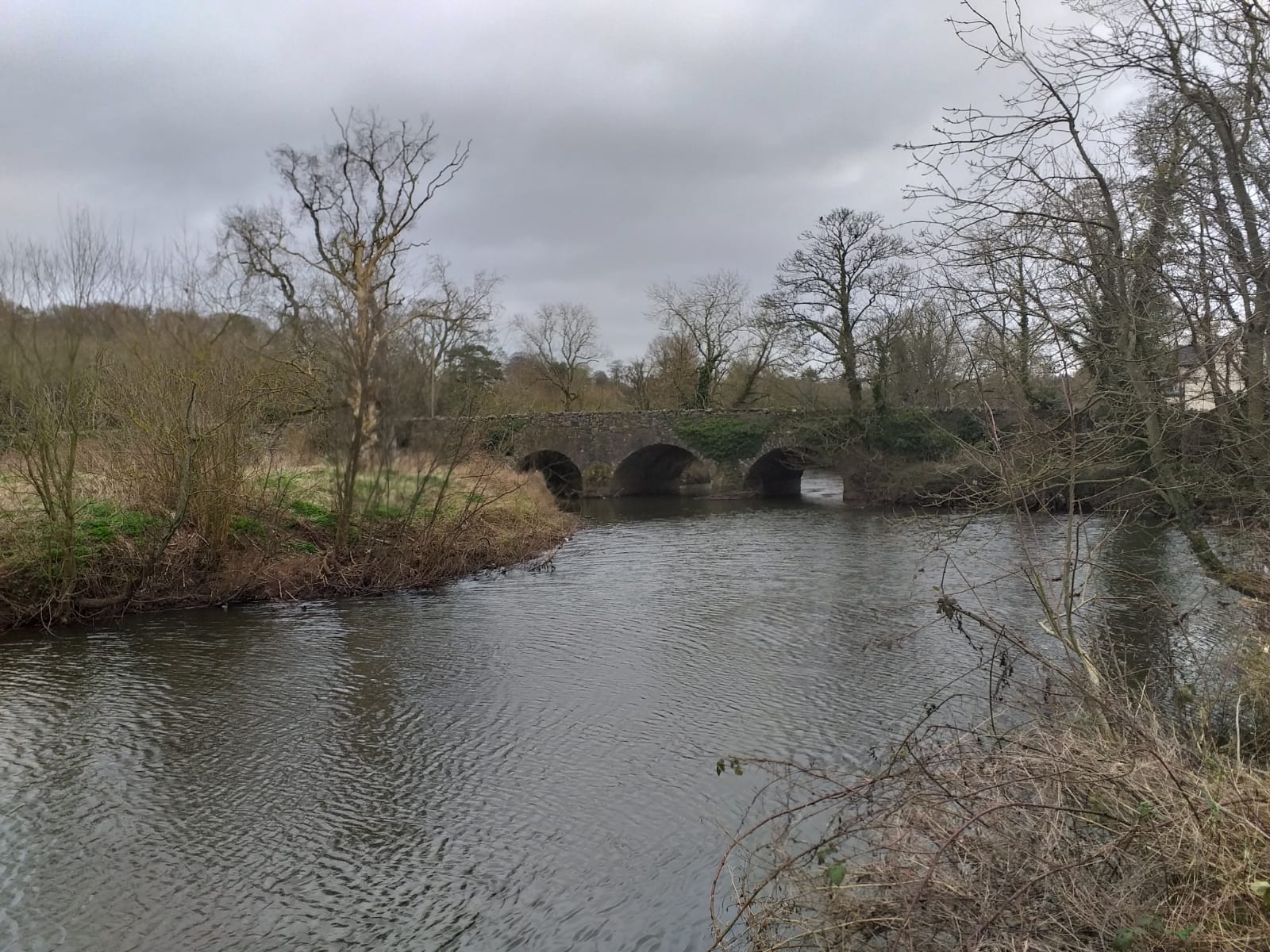
After a few hundred meters the Towpath and canal pass under the impressive looking Ballyskeagh Bridge.

A few meters passed Ballyskeagh Bridge I passed a sign showing Ward's Lock. Then after a few hundred meters I passed what looked like part of an old bridge. My map shows the Towpath following the abandoned canal is a much straighter route than the River Lagan. Which twists and turns its way further to my left.

Ducks swam in light green coloured water that looked unpleasant. The ducks didn't seam to mind though.
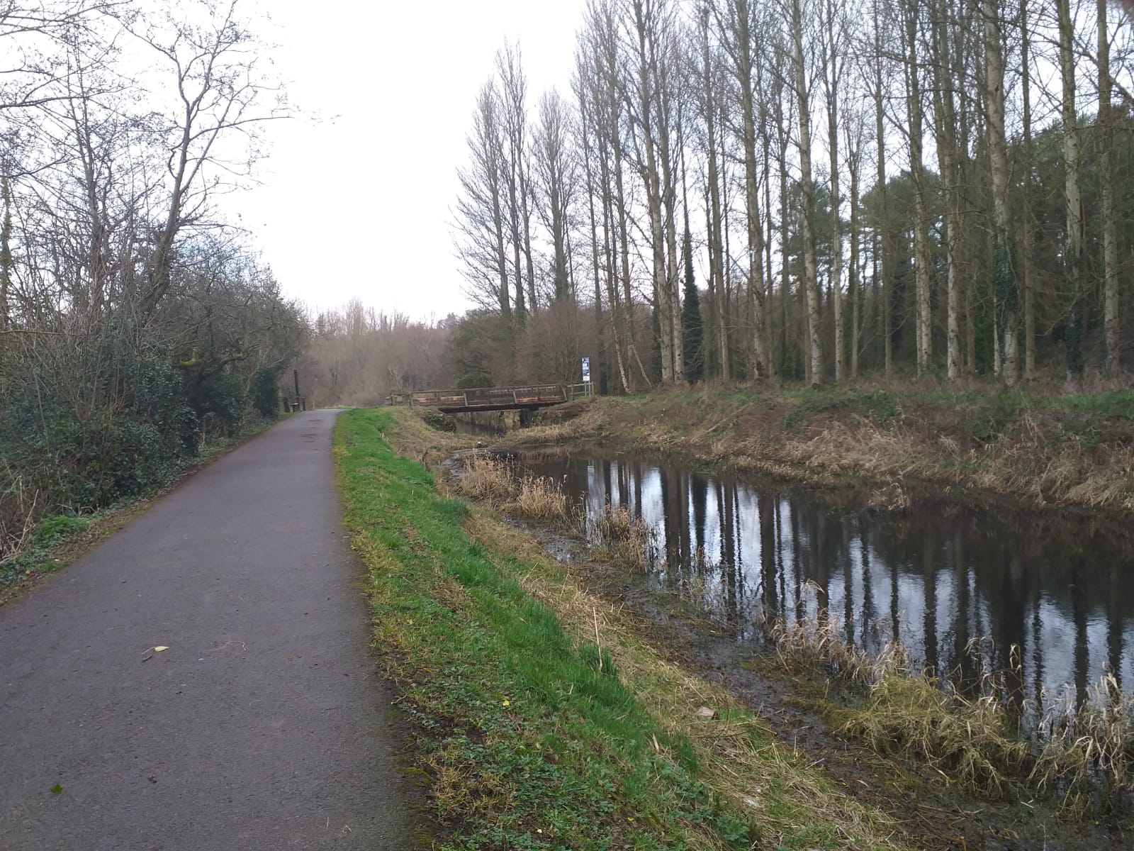
A few hundred meters and the Towpath drops slightly to pass under the very busy M1.

A sign showed I was now at McQuiston's Lock. It was only a few hundred meters and the canal re-joined the River Lagan. Sir Thomas and Lady Dixon's Park was on the far bank. I was walking almost south for a short while. A watery sun came out for a few minutes.

A few hundred meters and a bridge came into sight. After crossing the footbridge over the River Lagan which looped off to my right.

I walked the few meters by the canal towards one of the Drumbeg Bridges. I checked my phone and found I could collect a Geocache up near the church. So I took the path up to the road and turned right. Over the Drum Bridge, passed St Patricks Parish Church

I found the Geocache near the carpark opposite the church. Then walked down by the loop of the River Lagan.
Back to the green footbridge and to the other Drumbeg Bridge. I had walked a complete circle.

Walking under the bridge the River Lagan was now on my right hand side after being on my left for a number of kilometres. Malone golf club now ran on my left hand side. After a few hundred meters the River Lagan moved southwards while the Towpath and canal headed almost east.
A few more hundred meters and the Towpath passes under what was an old bridge over the canal.

The canal had a number of fallen trees and bushes growing almost across the canal so it must not have been used for many years.

I caught sight of this grey heron, he didn't seam that bothered by me, although I was only a few meters away.

At Rosie's Lock I crossed the footbridge over the canal. This is a narrow piece of land that lies between the relatively straight canal and the twisting turning River Lagan.

On one map I had, this is shown as Eel Weir on the River Lagan. I only crossed to this area to have a look for another Geocache. Unfortunately I did not find it.

Returning to the Towpath I turned right and continued towards Belfast. Malone's golf club still dominated the ground to my left. The village of Edenderry came up on the far side of the River, now the River Lagan and the canal had joined together and we were heading northwards.

It was peaceful walking along here. After a few more kilometres I could tell I was approaching a popular area as the number of people walking dogs increased. I spotted suspended over the river what looked like goals. Was it for water polo or canoe water polo I am not sure? Nobody was playing today whatever it was, the water looked too cold anyway.

The path rose a little when I saw a sign saying I was leaving Barnet Demense. I walked through a gate and I was in a carpark complete with ice cream van, I was at Shaw's Bridge. I stayed to the west of the River and continued along the Towpath.
As I moved from Shaw's Bridge I could see poles suspended over the River, these were for the canoe slalom. I was in an area called Clement Wilson Park, all very interesting. I was still on Cycle Route 9.
After a few hundred meters the Towpath crossed the River Lagan over the John Luke Bridge. The path turned left and I was now on the eastward side of the River.

Then the canal started again on my right. There was more people about as I approached some lock gates. I was walking in an area between the River Lagan and the canal. To the left was the Lockkeepers Cottage which was now a cafe.

There was a large barge tied up on the other side of this small bridge.

Continuing along the Towpath, using Red Bridge I crossed the River Lagan again. Following the River Lagan as it turns in another big loop.
I was now in an area with Lagan Meadows on my left.

After a couple of kilometres I saw a sign showing I was at Stanmillis Lock. Buildings were sprouting up around me as the Towpath moved to a road behind the Belfast Boat Club. At the top of the street I continued to follow the Cycle Route 9 signs. The path turns down back to the River Lagan passing the Queen's University Belfast Boathouse and continues under the subway under Governor's Bridge.

I was now on Stanmillis Embankment.

Passed King's Bridge. It wasn't as peaceful along here with the busy roads and noise of the traffic, after such a long spell of quite walking.

A few more hundred meters and I passed Ormeau Bridge. It was when I was near the Cromac Lock I got my first good view of the world famous H&W, Harland and Wolff cranes, Samson and Goliath.

This is Samson or is it Goliath a little further along the river bank behind Albert Bridge.

I knew I was nearing the end of my walk I could hear the noise of the City building up around me.

Near Queens Bridge I turned up towards the City. Leading down Ann Street and worked my way through the City Streets to Belfast City Hall

It had been a good day walking, with the contrast of the quite countryside and the busy bustling City. I had walked 24.5km with a 40m climb. All very interesting and somewhere I would like to visit again and see more of the place.
More to follow
Boz North
Details correct at time of walking.
If you have enjoyed reading my walk or found it useful you may also like to read other walks I have done in Northern Ireland or other areas. Please check out the links on the right hand side.
I'm a Belfast local and I am walking parts of the Lagan now and find your descriptions and pictures fascinating and useful - many thanks :)
ReplyDeleteThank you, I am really glad you like my post and pictures. I found it a really interesting place to visit. Hopefully I will get the chance sometime to go back.
DeleteI just found this! What a brilliant read !! I rent a wee holiday home for tourists in Lisburn beside the Lagan so I led this all .. I’m gona share your story on my page :-) marnies holiday homes Lisburn :-)
ReplyDeleteThanks Marnie that is brilliant. So glad it is useful. It was a really good day walking. You are so lucky living in such a lovely place.
DeleteExcellent
ReplyDelete