Wednesday 14 December 2011

CWT - Cape Wrath to Sandwood Bay 21 April 2010.

Cape Wrath Trail - After The Trail Day 12
Cape Wrath return to Sandwood Bay
Distance 13km
Wednesday 21st April 2010


After arriving at the Cape Wrath lighthouse I was concerned that there were only 3 hours of daylight left and it had taken me 5 hours to get here.  Since I had started on The Trail I had seen daylight hours getting longer but still there may not be enough for me to get back to my tent.  I was not very happy with myself due to the time it had taken me.  So after a couple of quick photos I headed back to my tent along the cliff path.  Wondering why did I not come this way in the first place.


If I had I would have had plenty of time, as it was I felt I was racing against the sun coming down.  Not for the first time on this walk I was frustrated with myself that I did not have the time to just sit and enjoy the beauty that I found myself in.


As I travelled along the cliff path, at times running, I could see the sun coming down.  I was sprinting against the setting sun.  I did not want to be wandering about on the cliffs in the dark with no kit.  After a while I would reach a rise and expect to see Sandwood Bay below only to see another rise ahead of me. The sun setting was brilliant with the colours on the hills being especially vivid. I saw herds of deer running majestically across the side of the hills, beautiful.


Then finally there below me was Sandwood Bay the beach stretching out in front of me. I stopped and filled my water bottles at a stream before reaching the bottom of the hill.  I crossed the river and stepped onto the beach just as the sunlight disappeared, I felt very tired but relieved.  After a slow walk along the beach dragging my stick and my full water bottles I saw the stone I had noted where I had to turn for my tent.  As I reached the rise of the sand dunes I suddenly heard a voice asked if I was OK? from a tent that I had not seen.  He told me I was not far from my tent.  I was almost on my knees when I reached my tent.  I started my jet boil and had a well deserved meal and settled down for the night.  Tomorrow I would have a lie in.


All that was left was a slow walk back the 13km to Kinlochbervie.  Even in the cold light of day when I reflected on the distance I had walked I still had no sense of achievement


More to follow


Boz North
Details correct at time of walking.
If you have enjoyed reading my walk or found it useful you may also like to read other walks I have done in Scotland or other areas. Please check out the links on the right hand side.

Follow link to my last day on Cape Wrath Trail - Day 12 Kinlochbervie to Cape Wrath


Monday 12 December 2011

CWT Day 12 - Kinlochbervie to Cape Wrath 21 April 2010.

Cape Wrath Trail - Day 12
Kinlochbervie to Cape Wrath
Distance 28km
Wednesday 21 April 2010


I felt quite smug with myself as I packed my kit and walked back up the road towards the Kinlochbervie Hotel for breakfast.  Today was the day I was going to reach my goal.


I had a full Scottish breakfast and even ate the black pudding which I don’t like, for I knew I would need all the energy I could get to not only finish the Trail but to get back to Kinlochbervie for transport to Inverness.

From the hotel I walked the minor road North through Oldshoremore to Blairmore.  


At Blairmore I turned right onto the track towards Sandwood Bay.  The sky was clear and beautiful.  


The route was well marked for people who must just come up to see the sands.  This was a little disappointing as I had expected it to be a little more remote.  On my way up the road the John Muir warden passed me with a trailer on the back of his van with what could have been a deer.  I remembered that he had told me the previous night that I may not get to Cape Wrath as the military were firing.  I told him that I had checked this out before leaving home and they had said there would be no firing on the two day window I had given myself to reach Cape Wrath.  He had looked doubtful.  Anyway I was committed now, this was the second day and therefore the last day I could reach Cape Wrath.  He gave me a wave and a smile as he drove passed.
   
The walking was pleasant  and I started thinking this was not too bad.  On the path I got my first glimpse of the Cape Wrath lighthouse.  


I found an ideal sheltered place to pitch my tent in the sand dunes behind the beach of Sandwood Bay.  I left my big bag, took my phone to ring home, map and compass, some water a few sweets and some money for the Ozone cafe, travelling light I set off.  Must not forget I also took my trusty stick.  It was really cold and the sand of Sandwood Bay felt cold and hard as stone.  I made a mental note of one of the rocks as a marker to my tent.  The sands of Sandwood Bay were beautiful and it deserved its credit as one of the top beaches in the world.  I walked to the North Easterly part of the beach and crossed the stream over into MOD land. 

For some reason which I cannot explain, I did not follow the route along the coast.  I set off across country, in a very haphazard route on the Eastern side of the coastal hills.  Which turned out to be a mistake as it was up and down, crossing streams, walking round, jumping and climbing in and out of bogs.  To eventually end up on the northerly road a good few km from the Cape Wrath lighthouse.  I was really annoyed with myself.  When I eventually arrived at the lighthouse I calculated it had taken over 5 hours from Sandwood Bay, now there was only approx 3 hours of day light left.  If I had followed the route along the coast I would have been well on my way back to my tent now.  Why I did it I cannot explain, anyway too late now, no time to hang around.  I had arrived with no sense of achievement or elation, this was the end.  The Ozone Cafe was shut and looked as if had been for some time, even though it was shown on a few web sites.  On top of that I could not get a signal to ring home.  


I had walked 28km, the total distance I had covered was 355km.

More to Follow


Boz North
Details correct at time of walking.
If you have enjoyed reading my walk or found it useful you may also like to read other walks I have done on The Cape Wrath Trail or other areas. Please check out the links on the right hand side.

Follow link to previous - Day 11 Kylesku to Kinlochbervie
Follow link to Cape Wrath to Sandwood Bay


CWT Day 11 - Kylesku to Kinlochbervie 20 April 2010.

TheCape Wrath Trail - Day 11
Kylesku to Kinlochbervie
Distance 40km
Tuesday 20th April 2010


At breakfast when everyone is sitting politely talking to each other.  I got into conversation with a couple of bikers from Southport, who was touring around the western side of Scotland.  I remembered them passing me yesterday as I came onto the road 4km South of Kylesku.  After they left talking to another couple who were up there on holiday.  It turned out they were from Gosforth and came up to this area quite a lot.  I mentioned that I thought I was getting too old to punish myself like this and Mrs said of course I was not. 

They were planning on trekking to the Everest base camp later in the year for a 60th birthday.  I thought when you are on your trek you will have Sherpa’s carrying your kit.  I was carrying everything myself.  Anyway I wish them well and hope they did it, as individuals we all of us each have our own goals and challenges.  Mr had walked a lot in this area and so he showed me a number of interesting places on my map.  It was good to talk to him.


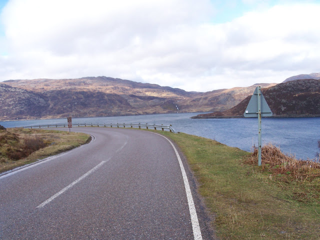
From the hotel I walked West along the side of the loch and up some steps to the road bridge.  The road bridge was relatively new and had replaced a number of ferries that crossed from Kylesku.  On the far side of the bridge there was a memorial for all the people who had died sailing in midge submarines.  The area had been a training ground during the war and the Kylesku Hotel had pictures of many of the crews hanging up in tribute to their bravery.


I stayed on the main road to Kylestrome where after passing the end of a small wood I turned right onto a track that was a steep climb from the start.  The track headed in a North East direction towards Achfary Forest.  Going over the track it was very windy and cold I had every kind of weather but the wind was a constant, mainly blowing in my face.  As I looked behind I could see Kylesku becoming smaller.


At Achfary Forest the track drops down into the relative shelter of the trees before arriving at the main road A838 near Lochmore Lodge.  Turning left at the main road I headed North West.  I had originally planned that at Achfery I would take the track called Strath Stack but decided when looking at my maps the previous evening to just stay with the road.  I tried to ring home from the phone at Achfary but it would not take coins only card, strange I thought.  Who would have thought of buying a phone card in the middle of nowhere.  


Anyway walking along the road at times the wind was that strong I could not see where I was going as I had my hat pulled down to protect my face and my hood fastened around my head. Many a time I stood and shouted at the wind to stop and give me a break.   There were snow showers, sleet showers, rain showers and sunny spells.  Sometimes I would get all of them at once.  I was now on my OS map 9 Cape Wrath that one of my sons had bought me for Fathers Day the previous year.

At Lochstack Lodge I had previously planned to turn off the road and walk round the bottom of Sail Mhor.  However due to the struggle and weariness I still felt from the previous day I thought it would be sensible to stick to the road although this was not what I had wanted to do.  The road was an easy route to follow, turn right at Laxford Bridge and follow it to Rhiconich.


Looking back on the day it was a good day walking especially after the problems I had had the previous day.  On this day I needed to reach at least as far as Rhiconich.  So instead of walking off route and overland as I had planned, I stuck to tracks and roads.  It was not what I had wanted to do but this was the only way I was going to finish in the time I had set myself.

Walking on the road was hard on my feet but I was at least covering the distance.  At one point when I stopped at Laxford Bridge I felt the eyes on me again and as I looked around I saw a young deer looking at me over a ridge.
 
I could not believe it when I arrived at the Rhiconich Hotel in time for an evening meal.  Today I had eaten plenty of food and felt well rested and the troubles from the day before were only a memory.  As I ordered my food three young walkers came in and we discussed The Cape Wrath Trail.  They said they had passed me in the car, and had read my note in the Knockdamph Bothy and said they were walking the Trail.  Which I found hard as how could they have passed me in their car if they are walking?  Strange but as I say we all have our own challenges and deal with them in our own way.

They had planned to stay in the hotel that night but as it was still light and the weather was pleasant now that the wind had died down I decided to move on a few extra km.  As I crossed the road to take the B801 towards Kinochbervie a warden from the John Muir trust pulled up in his van and offered me a lift.  I politely refused it as it would not have been right to take a lift. Anyway I carried on and planned to wild camp somewhere along the road.


The sunlight was beautiful as it lowered in the sky and the views were stunning.  I looked at a couple of places to stop but for some reason or other I did not.  Before I knew it I was in Kinlochbervie just as the light faded and headed up towards the hotel with an idea that I would ask if I could pitch my tent there.  As I was walking up to the hotel, I saw something flash across the road in front of me, it was a deer, within seconds the John Muir warden was pulling up in his van.  He suggested a place where I could pitch my tent but it meant I would have to go in his van and he took me back down the road.  On reflection I am sure he just wanted me off the roads in that area.  

He told me that deer had been causing problems in that area and he had already shot one and wounded the other.  Apparently that was the one that I had seen.  I think he had just wanted me out of the way of any further shooting.  Never mind I pitched my tent tied it to a couple of large stones as the wind looked like it was getting up again and settled down for a good night sleep with the thought that tomorrow I would reach Cape Wrath.  I had covered 40km in about 11.5hrs.

More to follow


Boz North
Details correct at time of walking.
If you have enjoyed reading my walk or found it useful you may also like to read other walks I have done on The Cape Wrath Trail or other areas. Please check out the links on the right hand side.

Follow link to previous - Day 10 Grid NC 346 184 to Kylesku
Follow link to next - Day 12 Kinlochbervie to Cape Wrath


CWT Day 10 - Grid NC 346 184 to Kylesku 19 April 2010.

The Cape Wrath Trail - Day 10
Grid NC 346 184 to Kylesku
Distance 22km Climb 300m
Monday 19th April 2010


I woke up to snow falling, I thought to myself this could be a good sign as it would freeze the bogs up, making the ground solid and therefore making the walking easier.  I would soon find out, as it happened it did for awhile.  When I was sorting my feet out getting ready for the days walking I put my seal skin waterproof socks on as my boots were soaking wet.  I need not have bothered as by the time I was going through my second river crossing, the water came over the top of my gaiters.


From my campsite the thin path continued North and crossed a number of streams of varying widths and depths before turning North West. 

Following the meal I had at the Orykle Bridge Hotel early the day before I had not had a proper meal.  This with the energy I had used in pushing myself to catch up with my plan meant I was now walking on low fuel.  The going was hard, I also had the snow/rain and hailstone flurries.  Totally different to yesterday, where nothing could slow me down and it was almost as though I had wings on my heels. Today my feet had turned into lead and it took a lot of mental effort to concentrate on where I was walking and push on.

The map shows after about 5 - 5.5 km from my campsite the path stops.  I think I must have lost the path long before then.  I was walking on bearings and still found it hard to navigate over the rough terrain.  Tiredness and lack of energy did not help.  I just kept walking in the direction where I hoped I would find the path. 


There were many ups and downs sometimes moving across bog and swampy areas then onto rocky outcrops that took me up steeply then down as steep on the other side.  On the side of one hill which was quite high up I came across an unexpected sight of a fox.  It was only because it moved I saw it as most of the day I had my head down and felt I was trudging for England.  It looked so different to other foxes I had seen, it had a thick dark fur and looked well feed, as usual it was gone by the time I got my camera out of my pocket. On reflection I have wondered if it was a pine marten and not a fox, but the area was open and exposed a long way from any woods, I thought pine martens habited wooded areas? (I have since seen pine martins and this was nothing like that so it must have been a fox.)


Eventually I found a path of sorts that was taking me in the right direction.  My map reading is not brilliant and I have been known to make mistakes but in this case I found I was on my planned track and came out after crossing near the top of a waterfall on the main road A894 just south of Cnoc Coire a Bhaic at a parking spot.  It was raining heavy now, all I had to do was turn right on the road and head North.


I walked through Unapool and turned right into Kylesku and went straight to the hotel.  There was no let up in the rain, on the road a couple of bikers passed me but other than these there was no other traffic.


I had planned to be at Kylesku by 14.00 but it was a lot later when I got there.  I also had planned to move on after I had had some food, but by the time I arrived there I thought I would not reach anywhere decent by night fall plus by staying I had the chance of breakfast and ordering a packed lunch for the next day, so I felt the sensible decision would be to stay the night.  This was not what I had wanted to do, I had eaten rations earlier than intended and was now concerned about getting supplies.  There were also reports that the weather for the rest of the week was going to be bad, worse than today?

I had walked 22km with approx 300m climb in 10 hours the pace was a lot slower than the previous day.  Looking at my map I had about 60 – 62km left before I reached Cape Wrath.  While in the warm I looked at my maps as I had to decide what and where I was going next.  I was going to have to change my planned route slightly to allow me to complete my task in the time I had left to do it.  I needed to be on the train to Inverness on Friday morning.

After a large three course meal of everything I could possibly eat, a couple of shandys I went to bed feeling more than a little frustrated with myself.  I was finding out that I must be one of the most discontented people I know.  Not happy with being away from work and doing what I like, walking, I felt as though I was punishing myself as I was failing to keep to my plan.

This day had been a hard day.

More to follow.


Boz North
Details correct at time of walking.  
If you have enjoyed reading my walk or found it useful you may also like to read other walks I have done on The Cape Wrath Trail or other areas. Please check out the links on the right hand side.

Follow link to previous - Day 9 Knockdamph Bothy to Grid NC 346 184
Follow link to next - Day 11 Kylesku to Kinlochbervie


CWT Day 9 - Knockdamph Bothy to Grid NC 346 184 18 April 2010.

Cape Wrath Trail - Day 9
Knockdamph Bothy to Grid NC 346 184
Distance 37km Climb 390m
Sunday 18th April 2010


What a different day, although frosty the sun was shinning and the sky was clear making the grass sparkle under the bright sunlight.  What a fantastic view I had outside of the bothy.  Most of my kit was still damp when I packed it away but after putting on a fresh pair of dry socks, giving my feet a rub for luck, boots on, pick up my bag, pushed the bolts on the bothy and with a whispered thank you set off.


The North Easterly track was easy to follow with only one small river crossing to make.  A few kilometres down the track I saw a small herd of wild deer, who just ignored me.  I was now in Glen Einig.  The track drops slightly to Duag Bridge where there was a wood carving of an otter and jumping fish, the only otter and fish I would see all trip.


I turned left onto a road which continued to climb North East, here I could choose between a forest track that entered Eining Wood or I could travel a path outside of the wood.  As the path outside of the wood looked slightly shorter I decided that I would walk this route.  Both paths joined again approx 2km further along anyway.  Where both paths joined I then took the path that turned slightly North before turning North Easterly heading towards Oykel Bridge.


Before reaching Oykel Bridge the path crosses another bridge and after approx 300m turns along the side of the wood heading North Westerly then hits the main road A837.  I turned left towards the Oykel Bridge Hotel.   


When I arrived at Orykle Bridge Hotel I thought it was shut.  I had planned to stop here for a meal and was ready for being disappointed but no, hallelujah their door was open.  I ordered a full breakfast with extra everything.  As I waited I wrote up my notes from the day before. With being so wet the previous night writing up my notes was the last thing I wanted to do.  After a lovely pot of tea I ordered two lots of sandwiches to take with me.


From the hotel I turned left back down the road, passed a phone box and turned left onto a forest track just before the Orykle Bridge.  On the corner I thought I saw an old snake skin.  The forest track turned North Westerly through Caplich Wood, and it was along here I also though I saw an eagle, hovering in the warm air.  It was too far away to take a decent photo of it, looking majestic as it just glided over the countryside.  Now travelling over open farm land and crossing a bridge near a farm I stopped and rested, it was now time to move onto my last OS select map. I felt now I was getting somewhere.


After approx another couple of km the path lead to the Western side of a small wood block before moving deeper into Glen Oykel.  Crossing a small stream the path followed the river to a place called Salachy.  The peace of the place was amazing as I sat in warm sunshine for a short rest.  I continued along a narrow path by the river, again in a North Westerly direction.  


It was along here I saw fishing sites all set up and marked like shooting buts.  I have seen many shooting buts but this was the first time I had seen fishing buts.  I thought fishermen would have just sat and fished anywhere along the river bank, it did not look like they could do this here.


The narrow path continued to follow the stream before turning North to a bridge which returned me to the substantial forest path.  Turning left onto the bridge I followed this path to the side of Loch Ailsh.  


Near the top of Loch Ailish is Benmore Lodge.  In my plans I had planned to stop here as I had read that this was a place to get food.  Unfortunately as I passed I could not see anywhere that looked like they would supply food.  It looked like a very expensive private holiday home.


I felt well and thought I would push on, I was still a day behind from the route I had planned, but hoped that by moving on I would soon make this up.  The track continued North and by the side of a wood.  At the top I turned right onto a small track heading more North East.  The track followed a small stream before climbing.  Looking back the views were stunning.  Further on the track took me to the East of Meall an Aonaich before passing a small loch. 


The shadows were getting longer so just before it got dark I found a nice dry place, with enough room for my tent right beside the path, I was about 22km off my planned target and felt good about the distance I had pulled back.  I had covered about 37km with approx. 390m climb in about 12hours and had found the energy to really push it that day.  


It had been a blinding day, due to the scenery almost all day I kept thinking of an old school hymn All Things Bright and Beautiful, all creatures great and small etc.  The purple headed mountain the river running by. The sunsets etc.  I was there and living all this, great the only thing I could not remember was did the hymn mention how cold it would be on that hill.


More to follow


Boz North
Details correct at time of walking.
If you have enjoyed reading my walk or found it useful you may also like to read other walks I have done on The Cape Wrath Trail or other areas. Please check out the links on the right hand side.

Follow link to previous - Day 8 Dundonnell to Knockdamph Bothy
Follow link to next - Day 10 Grid NC 346 184 to Kylesku


.