Wednesday, 6 September 2017

ECP - Low Newton-By-The-Sea to Craster - Northumberland 5 Sept 2017

English Coastal Path
Low Newton-By-The-Sea to Craster and Return
Northumberland
Distance 14km Climb 70m
Tuesday 5 September 2017


Dunstanburgh to Craster Number 9 on ITV's Britain's Favourite Walks shown January 2018.
The weather forecast for today was not very good and I was worried that this was going to be like another time Anne and I had walked this route, a few years ago. With rain in our faces all the way to Craster and rain running down our backs on the return to Newton by the Sea. I was so glad things did not turn out like that as I was showing my friends Ron and Ingrid some of the beautiful sites of the Northumberland coast.

It did start wet and overcast but not enough to spoil the day. I parked the car at the car park at the top of the bank from Low Newton by the Sea and we walked down the hill.


At the bottom of the bank we had a quick look in the quadrangle where the Ship Inn was. The plan was this was going to be our incentive for our return journey.

The tide was out and a great deal of the beach was on show.


We walked back to the path that turns from the road, with the footpath sign that leads to the back of the Ship Inn and some toilets. We turned left down the track between a number of holiday lets, passed the boat park, by a seat made from nets and broken crab/lobster pots, towards the Newton Pool Nature Reserve. It was raining a little heavier when we arrived at the bird hides. Today we had a look in. From the hide we could see a pair of swans and their cygnets a number of ducks, a goose and what I thought was a white heron. Looking it up when I got home it may have been an egret? Possibly a great white egret?

From the hides we followed the footpath round the edge of the bird sanctuary area and took the gentle climb up the rise to the edge of the golf course. On our way the rain had eased a little.

We followed the path by the golf course that twisted and turned by the greens, rising and falling along the sand dunes. I was surprised to see so many people out playing golf. We passed various sized beach huts/chalets that are set in and around the dunes. No one was using the chalets today. 


We continued along the path until it reaches a small rise that looks over part of the golf course. To the left is the sea. Dropping down the path, it turns slightly right to follow the stream inland a little, Embleton Burn. Following this for a few hundred meters we crossed the second foot bridge over the burn. After a short sandy rise we dropped onto the beach of Embleton Bay.


Continuing along the beach with its golden sands we climbed the side of a small gully joining the path across the top of the dunes continuing along the coast towards the castle. I know I should read up on things before my walks but it is after looking at things I find I am interested. Following my last walk to Dunstanburgh from Boulmer in December 2016 I read that the castle was also used as coastal defences in the Second World War. 


Following the path between the coast and the golf course, there is a small dip next to a golf tee, the path then rises up a bank to the green and hole. This is next to what I have heard people call a larva bridge, it looked even more impressive today with the tide being so far out. 


The path widens a little as we walked through a gate. Following the footpath below the castle we turned left up the narrow track that took us to the front of Dunstanburgh Castle.  


After a few photos we continued south towards Craster along the grass path. Cattle for some reason started running towards the north end of the field.


A lot of people were walking up from Craster towards Dunstanburgh Castle.


Even more people filled the cafe and the pub.

Ron and Ingrid asked about the stone on the end of the harbour. I couldn't answer, both Anne and I have wondered about this on previous visits. Looking it up when I got home, it appears to have been part of a larger tower used to load stone from a local quarry onto boats in the harbour.


We eventually found a table in the cafe for a spot of lunch, On leaving the cafe it appeared we had missed a heavy down pour as the road and paths were soaking wet.


Our route back to Low Newton by the Sea was a reverse of our route to Craster.


The weather was dry and we were now blessed with moments of warm sunshine.


The tide was coming in and we could see the difference on the lava bridge.


The sea now covered a good part of the beach.


We didn't stop at the Ship Inn on the way back. Just turned the corner and started up the ill towards the car park. Anne asked me to take a photo of the Victorian Post Box.


Reaching the car park it was very busy. Lots of people were taking advantage of the now sunny day. We had walked approx 14km with a climb of approx 70m. It had been a great day, hopefully do it again when Ron and Ingrid are next in the area.

More to follow


Boz North
Details correct at time of walking.
If you have enjoyed reading my walk or found it useful you may also like to read other walks I have done on The English Coastal Path or other areas. Please check out the links on the right hand side.

Friday, 1 September 2017

Harbottle to The Beacon and Lady's Well - Northumberland 31 Aug 2017

Harbottle to The Beacon return via Lady's Well
Northumberland
Distance 21.25km Climb 500m
Thursday 31 August 2017


I parked the car at the Harbottle Castle car park (150m). The last time I was here was a few months ago with Callum and Declan we could not cross the field to the castle due to lambing. As there was no lambing today I had a walk up to the castle, Callum and Declan would have loved it, next time they are up at ours, I will bring them here to have a look at the castle. 


It was going to be a lovely day for a walk. From the castle I walked back down to the car park. In the field opposite they were preparing for this weekends Harbottle Show.


Leaving the car park, turning left, east and walking back through Harbottle. I passed this fountain dedicated to Mrs Clennell, the notice shows Mrs Clennell was from Harbottle Castle. I do not think this would have been the castle ruin on the hill. The map shows a Harbottle Castle on the east of the village. I had a quick look down the lane to the east and the building I saw gave me the impression that this castle is a large house a private residence, so I did not go to close.


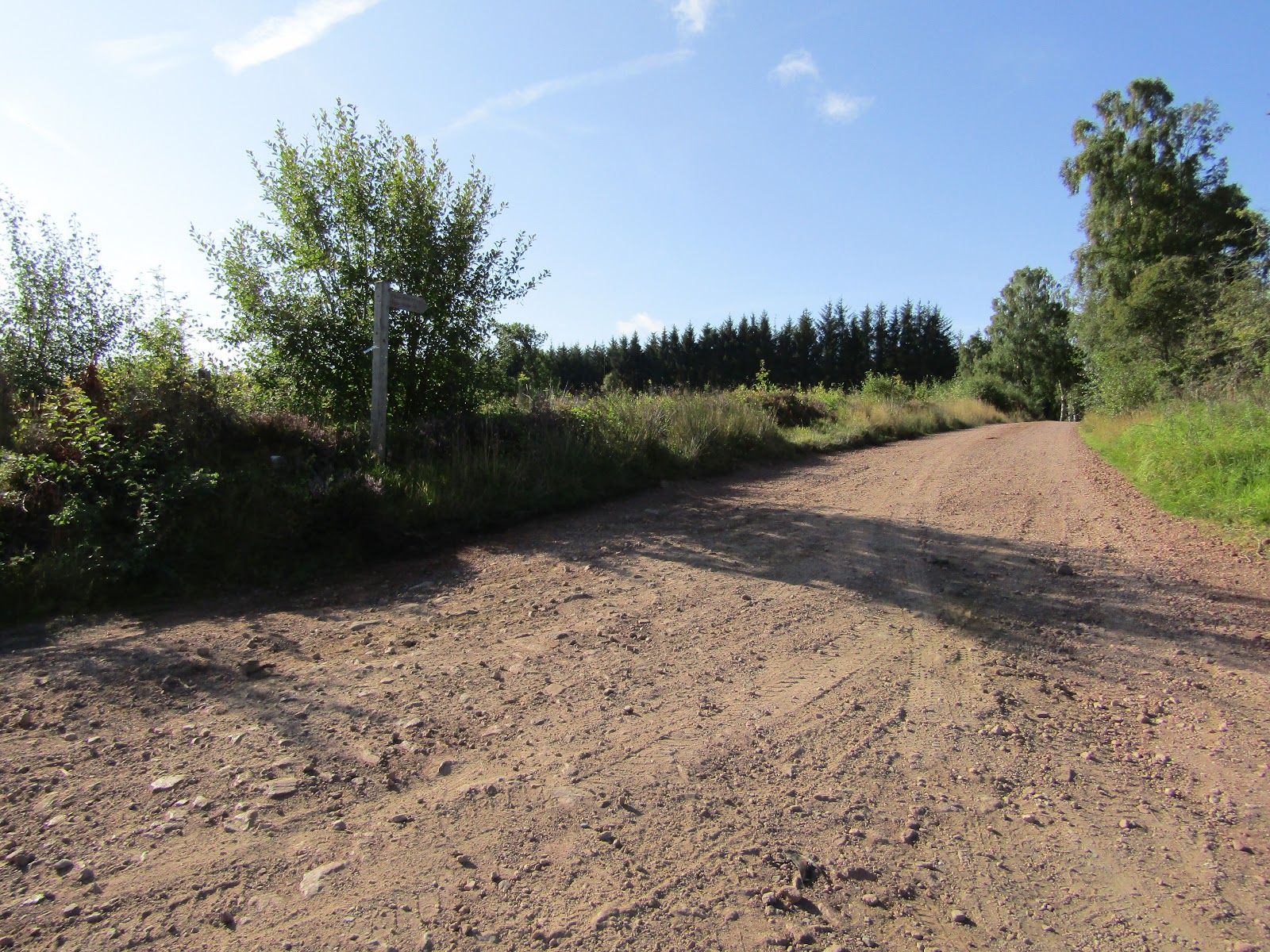
Back on the road I followed it south, downhill, leaving the village. It starts to climb up towards Rockey's Hall. I was heading for the footpath and forest track to the right just before the Hall. The track heads south west up through Harbottle Wood.


Walking towards the wood I saw the now familiar harvesting notice, fortunately I could still walk the track. Further into the wood the track gently climbs, after a couple of kilometres the tracks to the right and left are closed. The track I am on starts to be diverted right and left, it was difficult to follow on the map as to which track I had been led down. Eventually I came out into the open and I was able to orientate myself, I identified the Harbottle trig point. Continuing down through a felled area and walking up to the fence I reached a gate and style showing I was now on a public footpath in an area of access land.


Walking up the side of the fence before crossing an area covered in purple heather I reached the Harbottle trig point (361m). It was very warm, the height gave me a clear view all over the area. I was able to identify my next objectives. Pedlar's Stone and The Beacon.


After a drink of hot chocolate and taking a few photos. Down in Harbottle I could see the work for the Show was in full swing, a couple of large marques were being set up.

Walking back to the fence and the footpath, I crossed the gate and headed towards the ruin, south. On reaching the ruin, it looked so familiar, I am sure I have walked here before, years ago, a lot of years ago.


Continuing south on the footpath, the ground was very wet and boggy. Through a style and the footpath climbs a little. My map shows woodland to my left, but it looks like it was harvested some time ago.


Crossing over what appears to be newly tarmacked, the Burma Road, a new notice board shows you details of the area. I continued south by the fence as the footpath starts to drop slightly. Trees appear in the wood to my left.


As the footpath follows the fence to the west it continues to drop. Directed through another gate on the edge of the wood to the left, south the path drops steeply to a bridge over Yardhope Burn (200m).


Over the burn the footpath gently climbs east on the south side of the wood. On reaching the wall I turned right, south and started a steeper climb uphill.


Following the wall, when the footpath reached a road and gate Pedlar's Stone was a little ahead.


I am not sure if I found Pedlar's Stone but I had reached the cross shaped enclosed wood (290m). I had a little walk round the wood and this was the only stone I saw.


From Pedlar's Stone I turned left, loosely north east and followed the track. The views north and north east were stunning.


I followed a track as it turned south east behind a small square wood, heading towards The Beacon.


The track disappeared and I was on rough ground heading south east towards The Beacon. Reaching a fence line and footpath I crossed through a gate. Continuing over rough ground to a style. The ground was rutted due to previous harvesting, covered in heather, very high heather in places, this was making it hard to see where I was putting my feet. It was slow and hard walking.

Eventually I reached The Beacon trig point (301m). The views were a little restricted due to a few trees but it was warm and pleasant. As I had my jam sandwiches and a cup of hot chocolate the flies and midges were starting to irritate so I didn't hang about, shame as it was nice just to sit.


Crossing back across the rough ground now heading north west. I reached the fence line and footpath. Walking was a lot easier along here. When I reached the footpath that would take me to Holystone I crossed the fence and headed north east.


After a few meters it was hard to see where the footpath was, heather covered the area. I passed a number of large stones and continued down hill, north east. Making my way as best as I could.


I reached a fence and walked up hill to a style. For a few steps I was back on the footpath then it again disappeared. The heather in places was over knee high and difficult to walk through. Then as I wound my way down hill I reached deep areas of bracken, which made walking even harder. In many places it was over my head and I just had to push my way through, hoping I was going the right direction. My map showed I was in an area called Holystone Common.


I reached the corner of a wood shown on my map, the bracken had stopped and walking was easier. I headed north, the bracken had been flattened, I knew that on reaching a fence I would be near the footpath. Turning north east I could see the fence line but not a footpath. So just continued slightly down hill. More heather but thankfully no bracken.

The ground levelled as the fence came up from my left and trees came on my right, There was a loose path through, then some bracken that got higher and harder to push through as I continued to a fence. Looking for a style I saw one just down slightly to my left.

Over the style and the bracken cleared a little, I continued north east heading towards Holystone. I was back on a footpath and walking was easier. Crossing a narrow footbridge and I left the field onto a road.


A right turn, east, and I walked passed this well, which I believe is called St Mungo's Well.


The road turns sharp left, north and I passed the church, then the Post Office.


At the top of the road I turned left and followed the sign, for Lady's Well. It was nice and peaceful here.


The water was so clear.


After a short walk round to get some photos I left Lady's Well and continued north on the footpath that came out on to the road opposite Wood Hall. Turning left I followed the road with its ups and down and twists and turns back to Harbottle.

There were tents and large marquees set up now on the field opposite the car park ready for Saturdays show.


It had been good getting out and about, especially somewhere new. I had walked 21.25km with 500m climb. As I had a hot chocolate in the car park I felt a few spots of rain. I knew showers were forecast for the afternoon but they had fortunately held off until I finished. 

More to follow


Boz North
Details correct at time of walking.
If you have enjoyed reading my walk or found it useful you may also like to read other walks I have done in Northumberland or other areas. Please check out the links on the right hand side.


Monday, 28 August 2017

Thrunton Woods to Long Crag via Castle Hill - Northumberland 24 Aug 2017

Thrunton Woods to Long Crag via Castle Hill and Return
Northumberland
Distance 17.25km Climb 550m
Thursday 24 August 2017


I have been interested in walking in this area for some time, my friend John was talking about it a few weeks ago. So today on the spur of the moment I just made a few jam sandwiches, packed a flask, some water and set off.

I left the car at the car park and picnic area. The footpath through the woods to Castle Hill was closed due to contractors harvesting the trees. So I followed the diversion signs along the road north on the eastern side of the wood. The road follows the edge of the wood as it turns west.


I continued along the road until it became a forest track heading west. When I realised that if I had taken the footpath heading north west I could collect a trig point, I turned round. I was still a little disappointed I had not found the trig point or at least the mark of the trig point on Meldon Hill a few weeks ago.


Returning back along the forest track to the track/footpath junction, I then turned down the footpath on my left. It would have been on my second right had I not walked down the forest track. There is a small sign on the gate showing it is a public footpath.


Following the footpath north east the map shows it crosses the course of a Roman Road. A sign on a gate advises caution bull in field. Looking to my right it looked like I was in a field of young bulls, or at least curious cattle so I was a little relieved when I crossed a style into what appeared to be an empty field.

As I walked up the field and rounded a corner I saw that the field was not empty, there were what looked like more cattle to my left, looking larger than in the previous field, which one was the bull? At the top of the field I was just across from Whittonlea Quarry which is now disused. I climbed a gate onto the footpath to my right, east. My map shows the footpath goes directly across the field north east, however I followed the edge of the field east. At the corner I had a look into the field where the trig point was shown on my map. It was full of crops.


I walked left, to the top north west corner of the field looking for a possible route across the crop. I did not want to walk on the crops, I could not see anyway across and decided I would come back another time to collect this trig point when the crop has been harvested.


Returning back to the field with the bull sign and large cattle, my map shows a path that led to the north side of Thrunton Woods. Walking to the left of the field to avoid the residents I reached the gate and was met with the sign below. I sat on the style, had a cup of hot chocolate, looked at my map and had a think about where I would go next. I could hear the noise of trees being felled down the track in the wood to my left and activity up the track in the wood to my right.


After my chocolate I decided to keep out of the woods, so rather than walk back across the field I continued westward along the fence line, skirting the field and crossed the fence onto the road. Walking the road south west I crossed a civil parish boundary line. Turning left away from the road, I walked a footpath up hill following the boundary line south east, up into the wood.


After a short steep climb the path levels a little. It was nice walking through here. As I climbed I was getting warmer, a combination of the nice weather and walking up hill.


Where a number of paths join I could see to my left another warning sign of the harvesting. I turned right and started the climb up to Castle Hill (231m). Part of this walk reminded me of our walks through the woods of Austria and Slovenia the way steps are made from stone and tree roots. The rich colours of nature, the browns of the earth and soils. The greens of the plants and trees. The smell of it all and the clean fresh air, all beautiful.


I took a load of photos on Castle Hill, the majestic old looking trees, too many to include here. The ground felt soft from years of fallen leaves.


After another cup of hot chocolate and time looking at my map I decided to wander south. I saw on my map a feature called Macartney's Cave. It would have been a shame not to check it out.

As I moved south on the narrow path, dropping down, I could hear the cries of a couple of buzzards high to my right, as they were moving further over to the west. At the fence I heard a strange noise behind me, it sounded like a mountain bikes brakes on a steep descent. It must have been a couple of trees rubbing against each other in the gentle breeze.

From the style there were a couple of paths, I decided to take the one on the left. There is a short steep climb by some rocks and as I followed the path up I came across Macartney's Cave. Very interesting, on returning home I looked it up on the internet. One website shows a local monk from Callaly used the cave as a retreat, it is not very big.  


From the cave I continued upwards along the worn paths, climbing all the way.


As the path levels I reached this small pond, where I took the track to my right, heading south west.


The trees were thinning out and the countryside was opening up. I saw a mother and son collecting bilberries, she said they were collecting them for a crumble.


I followed the path down to a gate in a fence at Hard Nab then continued along a gentle climb to a cairn (271m). A sign on the gate mentioned ponies, but unfortunately I did not see any. Butterflies skipped and danced along the path, bees buzzed as I disturbed them on my way through. Heather gave the whole area a beautiful colour purple, and I was reminded of a hymn from school. All things bright and beautiful....the purple headed mountain. To the south I could see Long Crag.


Looking north east, I could see The Cheviots, Hedgehope and The Cheviot itself, clear and bright.


I sat with a cup of hot chocolate and my jam sandwiches, enjoying the view. After my sandwiches I walked the footpath south east through the heather.


I followed the path next to the wood as it dropped down to the stream, Coe Burn (180m).


After crossing the burn and the steep bank on the other side the path turns right, south west. Crossing a fence I could see my path climbing the hill side. The path starts gentle then turns steep, in places there are large steps and boulders to step up and over. A turn left, south east and the path continues to climb, reaching a large cairn. In the distance I could see the Long Crag trig point.


It was a gentle climb north east, almost level up to the Long Crag trig point (319m).


I continued along the ridge eastwards to cross the civil parish boundary line again. I could have walked the path north down the boundary line but decided to continue along the ridge following my path north east again.


Passing along Coe Crags east, with the majestic Cheviots in the distance.


They are slight climbs and drops until I reached another cairn.


The path then heads east down back into part of Coe Crags Wood. The path drops and turns north west, steeply in places.


At a path junction I turned north and followed the path down to Coe Burn. My map shows a footbridge, but I did not see one. It was very steep and slippery, through mountain bike tracks, down to the burn. After crossing the burn it was a short climb up to the forest track. Where I turned right, east.


Following the forest track east then north I reached another track junction where I turned right, north east and followed the track to the road.

On the road I turned left, north and walked up hill returning back to the car park and picnic area.

It had been a good day walking the weather was perfect, once out of the trees the views were clear, overall another brilliant day. I had covered 17.25km with a climb of 550m.

More to follow


Boz North
Details correct at time of walking.
If you have enjoyed reading my walk or found it useful you may also like to read other walks I have done in Northumberland or other areas. Please check out the links on the right hand side.