GMT - Kneesworth to Buntingford and Return
Cambridgeshire/Hertfordshire
Distance 42.5km Climb 525m
Saturday 6 March 2021
The road sign showed I was entering Bassingbourn-cum-Kneesworth but I think it would be more accurate to say I started at Kneesworth rather than Bassingbourn.

I left Kneesworth along the Old North Road, A 1198, the map shows this as Ermine Street, Roman Road. I was heading southwards towards Royston. My plan today was to walk part of the Greenwich Meridian Trail (GMT). I had only recently heard of the GMT a few weeks ago when I was walking to the Cambridge American Cemetery.
After looking up the walk on the LDWA website I joined it today on the A1198. At first I could not see the route sign for the "GMT" but spotted it a little way up the road on the post for a 50mph road sign.
Since writing this post I have looked further into the GMT route on the LDWA website and realise I have done a little of the GMT at the other end when I walked with Our Danny at Spurn Head Spit.

Walking by the road a kite flew overhead but I dithered and missed the chance to get a photo. This would be one of many chances I would miss, to take a photo of a kite as it flew overhead, throughout the day. It promised to be a lovely day weather wise. A little white frost covered the fields on either side but that would soon burn off.
After just over a km of climb to the top of the A1198 I crossed into Hertfordshire before crossing the roundabout and continued on the Old North Road. Passed the roundabout the road drops a little. The route is well sign posted once I had my eye in and knew what to look for.
A little way down Old North Road I saw a sign for the Meridian School over behind houses on my left. I wonder if this was named after the Greenwich Meridian Line that runs along here.
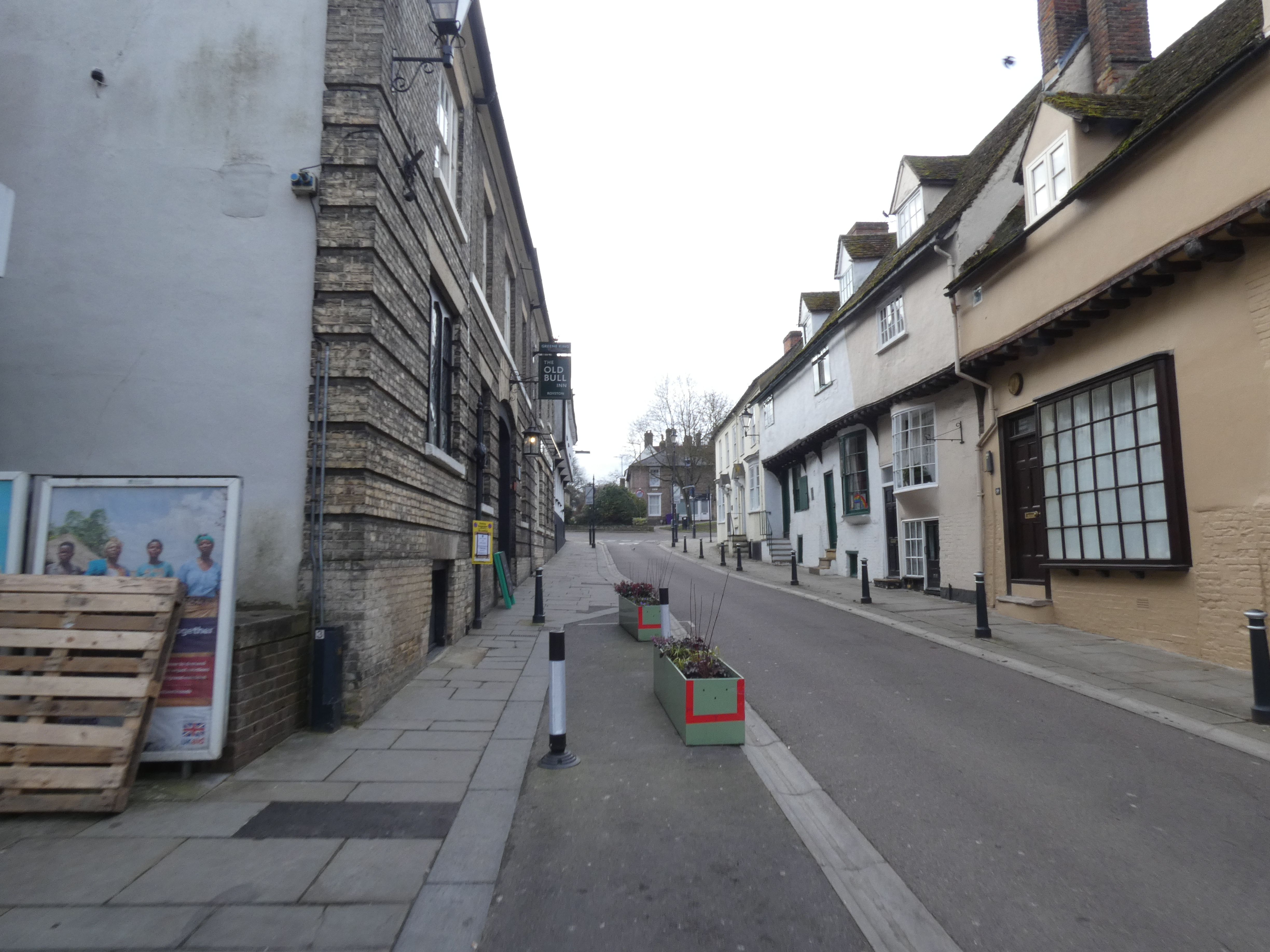
Passed Royston Railway Station the road is now called Kneesworth Street.

I had a little look at some of the feature of Royston. Which showed James stopped here on his way from Scotland to London to succeed to the throne to become King James I. He liked the place so much he stayed a few times renting places in the town for himself and his Court. Many buildings have blue plaques showing who stayed in them.

Passing the Stone, which I think was originally the base of a cross, I moved up onto High Street.

At the top of High Street a GMT route sign directed me left onto Barkway Street. Once around the corner I lost the route signs there were a few ways to go but from previously studying the route I knew I was to pass the bus station and continuing on Barkway Street. A little along the street I saw a route sign, confirmation I was going the right way.

Barkway Street becomes Barkway Road the B1039. A right turn up Beldam Avenue then a left onto Grange Bottom. I was now also on part of the Hertfordshire Way.

At the end of Grange Bottom the GMT and Hertfordshire Way become a narrow footpath.

Moving below some houses on my left, the path was muddy in places but nowhere near as muddy as my last walk. I think it was the slight chill hanging in the air that had kept the ground as hard as it was. Walking through the trees the path starts to climb and I was blowing a little as I reached the top.
Crossing the track that runs to Flint Hall Farm to my right, parts of a felled tree had been placed to make a perfect seat to stop for a short while. The view was lovely as I had a sip of drinking chocolate, collecting my thoughts and plotted my next stage. I had been carrying my walking poles on my bag and I decided now would be a good time to get them out.
I checked my phone and realised I could collect a couple of Geocaches on my way down the hill.

I was glad I had brought my walking poles as it was slippery in places. After collecting the Geocaches I continued down the hill.

Passing Grange Farm.

The path turns right through the gate.

A few meters along the track the GMT route signs turn left and start uphill between high hedges.

Through the hedges I could see in one of the fields a number of horses. At the top there is a gate, through the gate and looking through this gap in the hedge I could see my path stretching out ahead of me. The weather was turning warmer and the sun was pushing through the cloud I thought it was now time to take my woolly hat off.

Approaching Hatchpen I could see that the puddles had turned into ice. I could feel the ground under foot turning softer under the slight warmth of the sun so I didn't think the ice would last long.

A little closer towards Hatchpen the grass track turns into a tarmac road. Down to my left I saw what looked like a couple of geese cleaning themselves. On closer inspection there are a couple of ponds down there.
The road led down towards a large factory area whilst the GMT and Hertfordshire Way took me up a little footpath on the right.

After the rise it drops down again to cross the road and then heads up hill. After the factory area the path becomes slippery and steep, I was glad that I had my walking poles. There were signs horses are exercised on this part of the path.

At the top of the hill the ground levels off a little for a few hundred meters, before reaching a road, Shown on the map as The Joint. Turning left along The Joint it was only a few hundred meters before I was directed right.

Through the gate trees and bushes lined the path leading down hill slightly, then through another gate and I was heading into Reed.

Along High Street there are a few interesting looking buildings. I have only included a few of the photos here. Snowdrops lined the roads as they had in many other places.

There are a number of footpaths crossing the area but the GMT is straight along High Street and continues straight south.

I was now in an area of Wisbridge Farm. This is where The Hertfordshire Way turn left away from The GMT. I had to reset my phone to pull up Geocaches in this area.

My route followed the edge of ditches and the footpath ran below the level of the fields.

Following the path I collected another couple of Geocaches.

Following beside the ditches at a corner there is a bridge over the ditch. I continued with the ditch on my right hand side. I have since found the GMT route crosses the ditch and follows with the ditch on the left hand side. It did not add on that much of distance.
On reaching the road I turned right towards Buckland. A slight climb up the road.

Then I followed the route signs left along a grass track towards St Andrew's Church.

After a few photos I turned east down Daw's Lane.

Towards the bottom of the track it was very muddy. At the bottom I turned right and walked along a little. Just as the GMT turns left heading up hill I had a short rest for a short snack and a drink of hot chocolate.
After my rest I started uphill. I should have walked the right hand side of the ditch as choosing the left hand side when the path stops at a ditch junction it meant I had to jump the ditch.
After jumping the ditch and I was on the correct side I followed the path eastwards passing a giant hay stack.

Reaching a farm track I turned right headed south and walked down hill.

At the bottom my route was now still south but walking uphill.
Reaching the top a GMT sign directs me left, passed this nonsense gate which would not stop access in or out of the field.

Walking towards the sign I saw deer footprints in the mud and wondered if I would see any. After a few meters I saw a sign that directed me left across an open field. Although a marked footpath there was not enough footprints to show the route so I just headed in the general direction. After a few hundred meters I heard a kite, (it may have been a buzzard?) It was flying low to my left covering the low ground. Then I immediately saw this herd of deer, wonderful.
Continuing to walk in the general direction of the footpath I tried to get a little closer. Unfortunately they fled. I then decided to just follow a line of tractor tyre tracks to my left, then follow the edge of the field back to the footpath.

As I reached the edge of the field I turned right and saw a couple of walkers coming towards me. It may have been them that spooked the deer?
At the end of the line of trees I was back on the GMT route.

Turning left I walked down the track, over to my right I could see what is shown on the map as Wyddial Hall. I am sure I saw a Belted Galloway in the grounds. It is the only cattle I can identify.
The track turned slippery as it climbed by the grounds of Wyddial Hall. Reaching the road I turned right and walked passed the entrance to Wyddial Hall.

The road turns sharp right then a sharp left passing St Giles Church.

Just passed the building on the left in the photo above there is a tree that has been planted for the Millennium alongside this post to commemorate the anniversary of the Greenwich Meridian in 1984.

The road turns sharp left then after a few meters sharp right. I read somewhere, apparently the houses in Wyddial were originally built for the staff who worked in Wyddial Hall.

After a few hundred meters the GMT turns left down Moles Lane. I knew this from studying the route before leaving my accommodation. Unfortunately I could not see any route signs at the junction to confirm the route for me. I may have missed them because the route has been marked so well so far.

At the end of Moles Lane there is a GMT route sign confirming this was the correct route as it continues as a footpath.

On the corner of the field I left the GMT. The GMT continued to my left, I however followed the footpath sign towards St Bartholomew's Church and Buntingford. I headed south then turned west then turned northwest up towards the Church. I have since found the Church had been derelict and since been turned into a house.

Passed St Bartholomew's I saw a llama farm or are they alpacas?

Turning around I followed The Causeway this led me down hill, passed a school, over the ford over the River Rib and into Buntingford.

Buntingford looks a lovely place to visit.

I have since found out it gets its name from an old Saxon chieftain. The article also made the point that it is not named from the festive flag decorations and is recorded as Hertfordshire's smallest town.


After a short rest and a snack with another cup of hot chocolate I had a quick walk round the town before heading back.

Once over the River Rib my route back was much the same as my route out.

I did make a couple of diversions to collect a few Geocaches.
Passed Wyddial Hall I was crossing the field where I had previously seen the deer. I had decided to follow a set of tractor tyre tracks straight across the field and on reaching the ditch at the far end turn right and re-join the GMT at the corner of the field, where the obsolete gate was. As I crested a rise I saw the deer again in almost the same place I saw them on my route out, brilliant, I was so glad I saw them again.

Reaching the top of Daw's Lane at Buckland again I went off my route slightly. I turned left up Back Lane and crossed the A10 to collect a Geocache. Returning to my route on a footpath to the north of St Andrew's Church.

Returning to my route out I continued back along the same way only stopping to collect some of the Geocaches I had previously missed.
Then back through Reed.


Then all the way back to Royston.
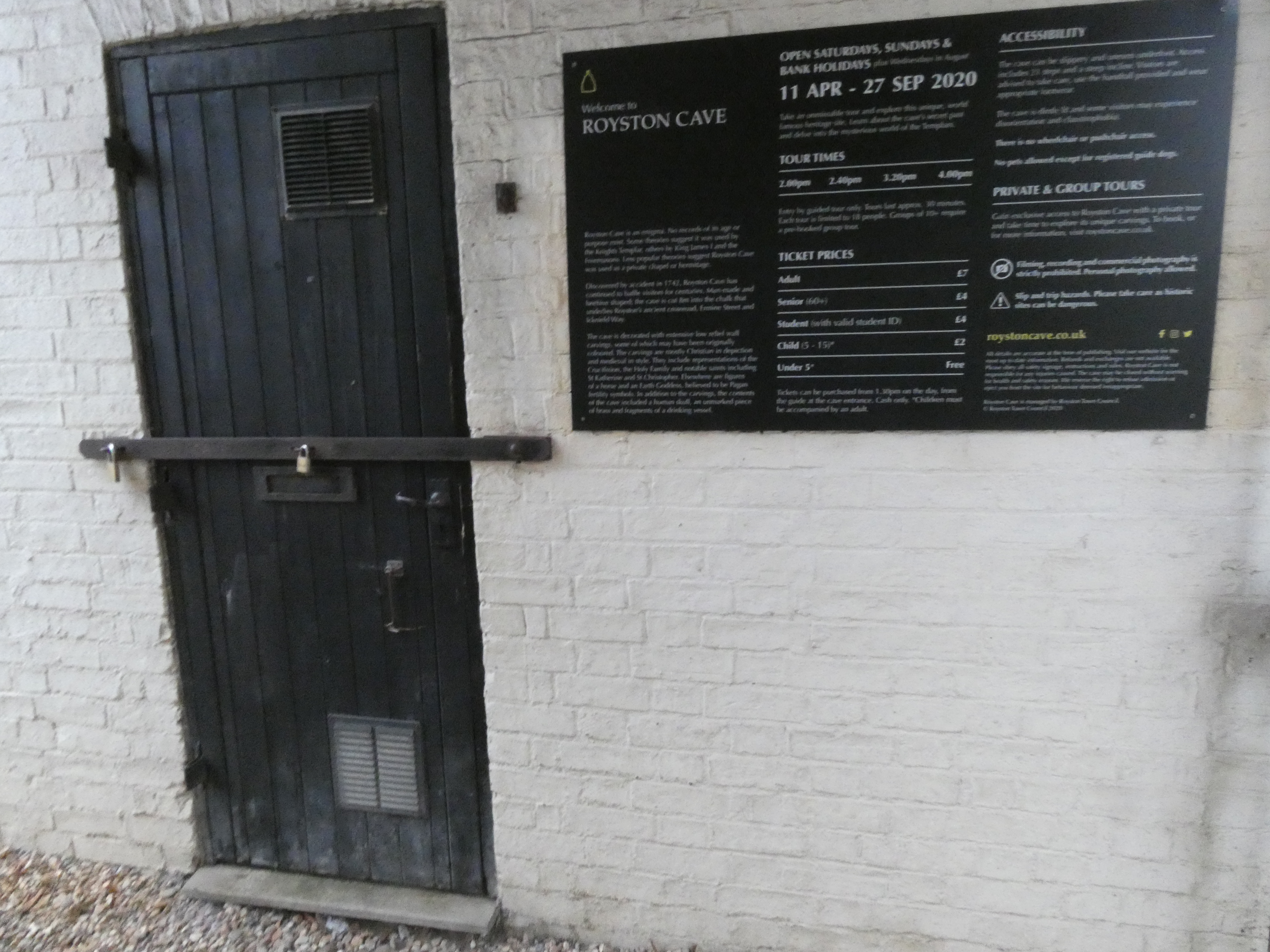
On my way through Royston I found the Cave.
Stopped for some chips by The Palace.

Continued along Old North Road and took this photo.

Returning to Cambridgeshire.

Down the hill to Bassingbourn-cum-Kneesworth.

Reaching Kneesworth.

Then it was just a short walk to my accommodation. It had been a good day walking, I was tired but felt good, I was glad for the good weather and the shortage of mud. Today I had covered a distance 42.5km with climb 525m. Buntingford looks a nice place I will have to go again.
More to follow
Boz North
Details correct at time of writing.
If you have enjoyed reading my walk or found it useful you may also like to read other walks I have done in Cambridgeshire/Bedfordshire/Essex/Hertfordshire or other areas. Please check out the links on the right hand side.
No comments:
Post a Comment