Weardale Way
Houghton Gate to Gilesgate Durham
Co Durham
Distance 15.5km Climb 225m
Saturday 9 December 2017
I had arranged for us to be dropped off at Houghton Gate. It is shown as a private road but has a public footpath sign, we crossed the style.

The road crosses over the A1. The weather forecast showed that it was going to be another fine day, it would be very cold but should remain dry and sunny.

The road twists and turns a little passing The Manor House before turning into a grass track through Lumley Park Wood. It is nice walking down through the Wood and today the path was dry.

As the path levelled at the bottom of a short bank, down to our right we could see Lumley Park Burn. The path dropped and twisted, at times following the Lumley Park Burn. After a map check at Lamb Bridge, we continued on the north side of the Burn.

A little ahead through the trees we could see the back of Lumley Castle.

A little further the footpath follows a wall leading to a house. Following a previous walk here I checked an old map on the internet and found the house was previously called the Garden House. Looking through an opening in the wall, it did look like it had been a walled garden a long time ago for the big house.
The footpath is signposted to the right of the house. At the far end a little gate shows Waugh's Way, I still have not been able to find out who Waugh was.

From the house the a narrow track drops down to the Burn, today it was not slippery as it had been on my previous walk along here. A grey heron was disturbed and flew along the Burn. Glenn had to help me spot it among the trees when it stopped.

At the north of the footpath there is a couple of track junctions, so we had another little stop to check our navigation. The footpath we were following turns left, south.

Continuing south at the next track junction we crossed over a small bridge onto the south side of the Burn taking us onto the golf course. Following the footpath signs we crossed the golf course and turned south west.
Near where Lumley Park Burn joins the River Wear we followed the footpath that takes us by a fence. As the path heads south we were walking between the fence and the River Wear. Looking left across the Chester-le-Street Golf Course we could see the impressive Lumley Castle.

Near the Club House we met up with Davie and Yorkie, it was good to see Davie out. This was where we joined the Cuddy's Corse walk. From my previous walks I had learnt that "Cuddys Corse" is a walk along which the St Cuthbert's Community carried St Cuthbert's coffin, the Lindisfarne Gospels and other relics belonging to other Saints from Chester-le-Street to Ripon. Eventually returning to the area, stopping on a prominent piece of land and having a city build around it. A city we now call Durham.
We followed the footpath south by the River Wear, passing under Lumley New Road. The Riverside, Durham Cricket Ground soon appeared on the opposite bank. After approx 1km the path moves left slightly climbing away from the River, funnelled between fences and trees. At the top there is a style to climb, the route is across a track. On the other side is another style then the footpath heads further up hill a little.

Coming out of the wood the path heads south east by the edge of the wood along the side of an open field. At the top we turned east and followed a hedge line as it climbs to the top of the field. Cross the style, directional signs show turn right, south.

To the right there
is another style. Once over this style the footpath climbs steadily upward
heading south, by the edge of a field. The bright clear sunshine made my photos look like silhouettes.
At the top of the field the path turns sharp left, east, up to the road. We were now at Great Lumley. Looking back we could see The Riverside Cricket Ground, The Angel of the North and Lumley Castle on which we had a short discussion.
A right then left turn and we walked along Front Street. Unfortunately the Old England was closed so we continued. At Christ Church we turned south down Cocken Lane. It was along here we caught our first glimpse of Durham Cathedral, far in the distance.

Leaving Cocken Lane just as the pavement runs out we turned right, crossed by the football pitch to join the footpath that runs south from the village, trying to keep off the rod as much as possible. However we had no choice but to return to Cocken Lane near Charles Pit cottages and continued south.

The road drops and climbs a little up to a T junction with Cocken Road. Here we spilt for awhile, the main group continued following the Weardale Way sign left to Finchale Priory, while I went with Richie to check out a Geocaching site.

The Geocaching site was not far from the junction. This was the first I had seen.

Returning to the junction Richie spotted another Geocaching site nearby, so we continued along the road to the lay-by and so instead of the steps we took the sloping path that leads down towards the River Wear.

Following the directions we soon found our second Geocaching site.

A short walk along by the river brought us to the bridge to Finchale Priory where we met up with our friends.

After a short refreshment and a quick navigational check we continued towards the road west to leave Finchale Priory.

Following the road west as it climbs from Finchale Priory, with its twists and turns south west. We passed what appears to be an old ammunition storage area. Dylan asked me to find information about the site. Unfortunately I have been unable to find anything about it. Social websites show it as Brasside ammunition dump. It does not show on old maps, probably due to the secrecy and security at the time.

A sharp left turn by Priory Cottage and we were heading south. Reaching the road junction a little navigation check and we turned right. After a hundred meters we turned left south again between the prison and Low Newton Remand Centre. After a short walk through the car park there is what looks like a path next to the wall and a path to the right, take the path too the right. Looking at the old maps I found that we had walked on the wagonway that would have joined the ammunition site to the main North East Railway (NER) line at the time.
Walking along the wagonway, hedges start to hide the high walls to the left, as we moved south, then south east. At the sharp left turn, Dylan asked me about four tall poles. This was where the ammunition wagonway joined the main NER Bishop Auckland Branch Line at what had been Frankland Junction. However I am not sure if the four poles had anything to do with the wagonway as they are on the side which old maps shows as a brick field. It appears the brick field was on the north west corner of this junction. In later years Frankland Brick works was on the north east corner of this junction. So it may be that the four poles had something to do with either the brick works or Frankland Junction.
Turning south west we continued on Cuddy's Corse as it passes Dovecote Farm Boarding Kennels and Cattery. It was very pleasant walking along here.

As the fields opened to the right we could see the busy East Coast Main Line where trains run from Edinburgh to London. At the bottom of the bank at a track junction a short navigation check and we continued south through Frankland Farm.
At the farm we turned right by the last building to get a stunning view across to Durham Cathedral. Looking at the old maps it is possible that this part of the farm dates back before 1860. Although it is believed that the area was farmed back in Medieval Times.
Passed the buildings we took a sharp left turn onto another tarmac road that led us down hill.

It is clearer from this angle that the trebuchets are still in place following the Siege of Durham in 1091 by Malcolm III of Scotland. Conflict was averted and a renewal of the Treaty of Abernethy was revised.

Walking down the road you catch a view of the River Wear just before the junction where we turned right onto Frankland Lane. The road continues between fields and passes a water treatment works before turning sharp right into a wider road.

Walking Frankland Lane as it follows the river into Durham City, passed Crook Hall. We stopped briefly at the Pennyferry footbridge for a quick photo before we crossed the River.

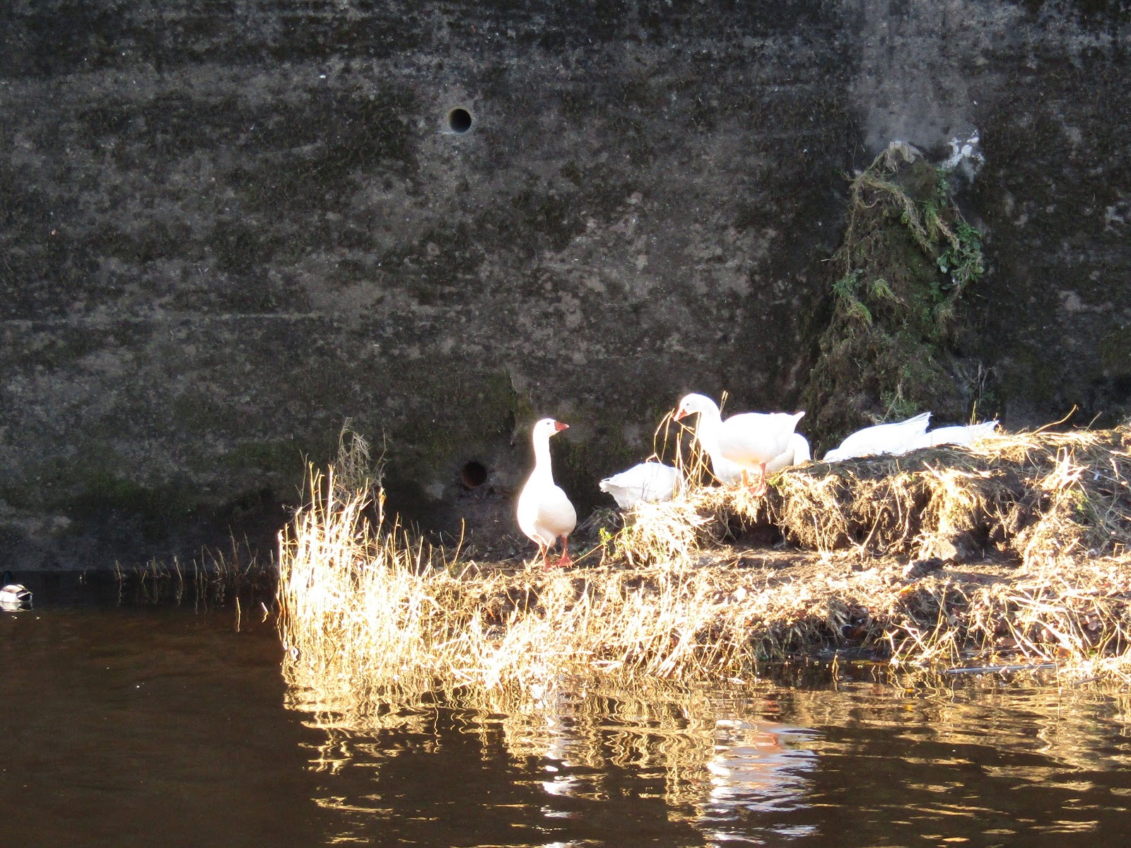
On the other side of the River I turned left and followed Richey to the riverbank where I saw some geese sitting below the bridge.

Meeting at the road junction we turned left to walk up Providence Row, passing St Nicholas Burial Ground.


At the top a further climb left up Gilesgate.

Stopping at the top.

I had enjoyed our walk, we had covered 15.5km with a climb of 225m. Thanks to all the lads and lass for a great day out, hope they enjoyed it. Special thanks go to Dylan and special thanks to Richie for showing me the joy of Geocaching.
More to follow
Boz North
Details correct at time of walking.
If you have enjoyed reading my walk or found it useful you may also like to read other walks I have done on The Weardale Way or other areas. Please check out the links on the right hand side.
Previous walks in the area Worm Hill to Finchale Priory March 2017.
Finchale Priory to Shincliffe June 2017.
Chester-le-Street to Durham City 28 November 2017.
No comments:
Post a Comment