Wedder Leap to The Cheviot and return
Northumberland
Distance 26km Climb 710m
Wednesday 4 January 2017
It was very cold when I left the car park at Wedder's Leap (240m). I had walked this route in reverse a few months ago as part of my Northumbria Trail Day 2.

I crossed the road to the footbridge. My route over the stream followed the wall east. Moving through the gate, I followed the footpath north towards Barrowburn.

At the top of the field, through a gate the footpath joins a farm track heading north as it moves up by a small wood and drops down to run by a small stream. After a few hundred meters it then climbs steeply away from the stream.

After the climb, it drops down slightly to a gate into the wood on Middle Hill. The style was slippery due to the frost and cold. Through the wood the air was a lot warmer.

Following the footpath left, west through the trees it turns right and north again following a forest trail.

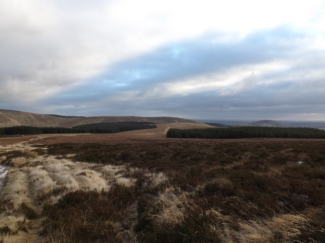
Since my last walk through here, a lot of the wood has been harvested on the eastern side. This has opened up the views across to The Middle and Hazely Law.

The path was muddy but firm due to the cold. Walking down hill to a style and across the side of The Middle, I continued to follow the footpath north. Over another a style, a track and I was walking along the western side of Hazely Law.

The higher I climbed I could see that ice had formed in the puddles, parts of the path would have been slippery with mud, fortunately with the cold the path was solid and on the whole good underfoot.

After a steep climb the path crested a rise before dropping down over a small stream, Hazely Slack, that runs into the wood on the left, the path then climbing again.

The Cheviot appeared to the right, a beautiful orange and brown colour, it looked stunning, unfortunately none of the photos did it justice. A gentle, steady climb leads up to The Pennine Way (542m). The sun was shinning and the views brilliant. On reaching The Pennine Way I turned right, north east and headed towards The Cheviot.


Walking along the path was good in places but in others I had to take care as water had turned to ice. In some places due to the brightness of the sun I slipped on patches of black ice. Fortunately where I could see the ice on the path, the once deep, soft, bogs on the sides of the path were solid enough to walk on.
With a cold wind, very cold icy wind, direct in my face, I was concentrating so much on my footing I walked right passed the King Seat trig point (531m) without noticing it. The sun disappeared and it looked like it was turning cloudy as I climbed higher, typical. From a distance The Cheviot looked clear of cloud and now it was changing as I approached.
Reaching the style where The Pennine Way heads right, north west, towards the Mountain Refuge Hut, I used the style that continued right, east towards The Cheviot.

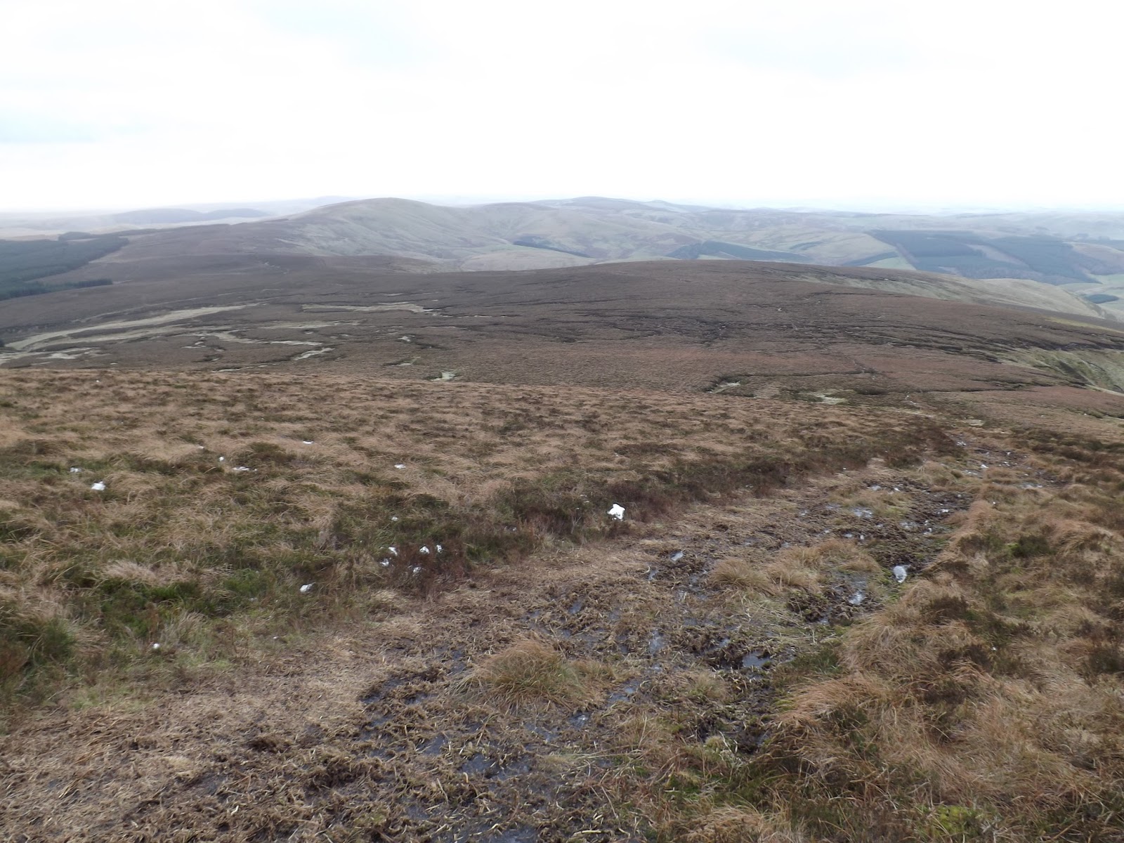
I was just about on time with my time estimation as I approached Cairn Hill (777m).

The views east was brilliant.

On the last part of the climb, just before The Cheviot came into view a few parts of the path were sheets of solid ice stretching far into the bogs on each side, so extra care was needed. I reached The Cheviot trig point (815m) which had stayed amazingly cloud clear.
The Cheviot trig point has been repaired since my last walk in August. A new concrete base, all the stones reset and the trig point stone mended. Really good work, thank you to those who did this work.
While having a hot cup of tea from my new flask, and a sandwich I was joined by a couple, who had walked up from Langleeford. The only people I had seen on my walk. After a few minutes they walked on west and were going back to their car along the footpath south from Cairn Hill.

Once I had finished my tea and sandwich, I set off returning by the same route I had come in on.


In places where there are no stones, the ground was solid, no give at all. In places I had to take care as the grass was like glass, so slippery. It was along here I noticed that I could not get any water from my Camelbak as the water in the drinking straw had frozen.

I saw King Seat trig point (531m) on my return journey.

A little lower down the hill the temperature had risen a little and in places the ice had melted a little and water was now lying on ice, making it slippery and I had to be careful. On reaching the footpath junction towards Wedder's Leap I turned left and started heading down hill.
In places what had been solid ground on my walk up was now muddy and slippery on my way down. It was really quite warm compared to my walk up. Even the water in my Camelbak had defrosted.

At the bottom of Hazely Law, I crossed the track to walk the eastern side of The Middle. I could see the area of wood that had been harvested on Middle Hill.

Dropping down from The Middle, through the gate and up the forest track on Middle Hill. Turn right along the footpath, along another forest track, then turn left for a short step through the trees to reach the track that runs up to the gate on the south edge of the wood.
In the open follow the path up a short rise before dropping down to the stream.

Follow the stream a few hundred meters before climbing up beside the small wood. Then follow the path down to Barrowburn.

A left, south along the wall and a right, west over the field and footbridge back to Wedder's Leap and the car park.

A great day walking, cold but dry I had covered 26 km with 710m climb.
More to follow
Boz North
Details correct at time of walking.

I crossed the road to the footbridge. My route over the stream followed the wall east. Moving through the gate, I followed the footpath north towards Barrowburn.

At the top of the field, through a gate the footpath joins a farm track heading north as it moves up by a small wood and drops down to run by a small stream. After a few hundred meters it then climbs steeply away from the stream.

After the climb, it drops down slightly to a gate into the wood on Middle Hill. The style was slippery due to the frost and cold. Through the wood the air was a lot warmer.

Following the footpath left, west through the trees it turns right and north again following a forest trail.

Since my last walk through here, a lot of the wood has been harvested on the eastern side. This has opened up the views across to The Middle and Hazely Law.

The path was muddy but firm due to the cold. Walking down hill to a style and across the side of The Middle, I continued to follow the footpath north. Over another a style, a track and I was walking along the western side of Hazely Law.

The higher I climbed I could see that ice had formed in the puddles, parts of the path would have been slippery with mud, fortunately with the cold the path was solid and on the whole good underfoot.

After a steep climb the path crested a rise before dropping down over a small stream, Hazely Slack, that runs into the wood on the left, the path then climbing again.

The Cheviot appeared to the right, a beautiful orange and brown colour, it looked stunning, unfortunately none of the photos did it justice. A gentle, steady climb leads up to The Pennine Way (542m). The sun was shinning and the views brilliant. On reaching The Pennine Way I turned right, north east and headed towards The Cheviot.


Walking along the path was good in places but in others I had to take care as water had turned to ice. In some places due to the brightness of the sun I slipped on patches of black ice. Fortunately where I could see the ice on the path, the once deep, soft, bogs on the sides of the path were solid enough to walk on.
With a cold wind, very cold icy wind, direct in my face, I was concentrating so much on my footing I walked right passed the King Seat trig point (531m) without noticing it. The sun disappeared and it looked like it was turning cloudy as I climbed higher, typical. From a distance The Cheviot looked clear of cloud and now it was changing as I approached.
Reaching the style where The Pennine Way heads right, north west, towards the Mountain Refuge Hut, I used the style that continued right, east towards The Cheviot.

I was just about on time with my time estimation as I approached Cairn Hill (777m).

The views east was brilliant.
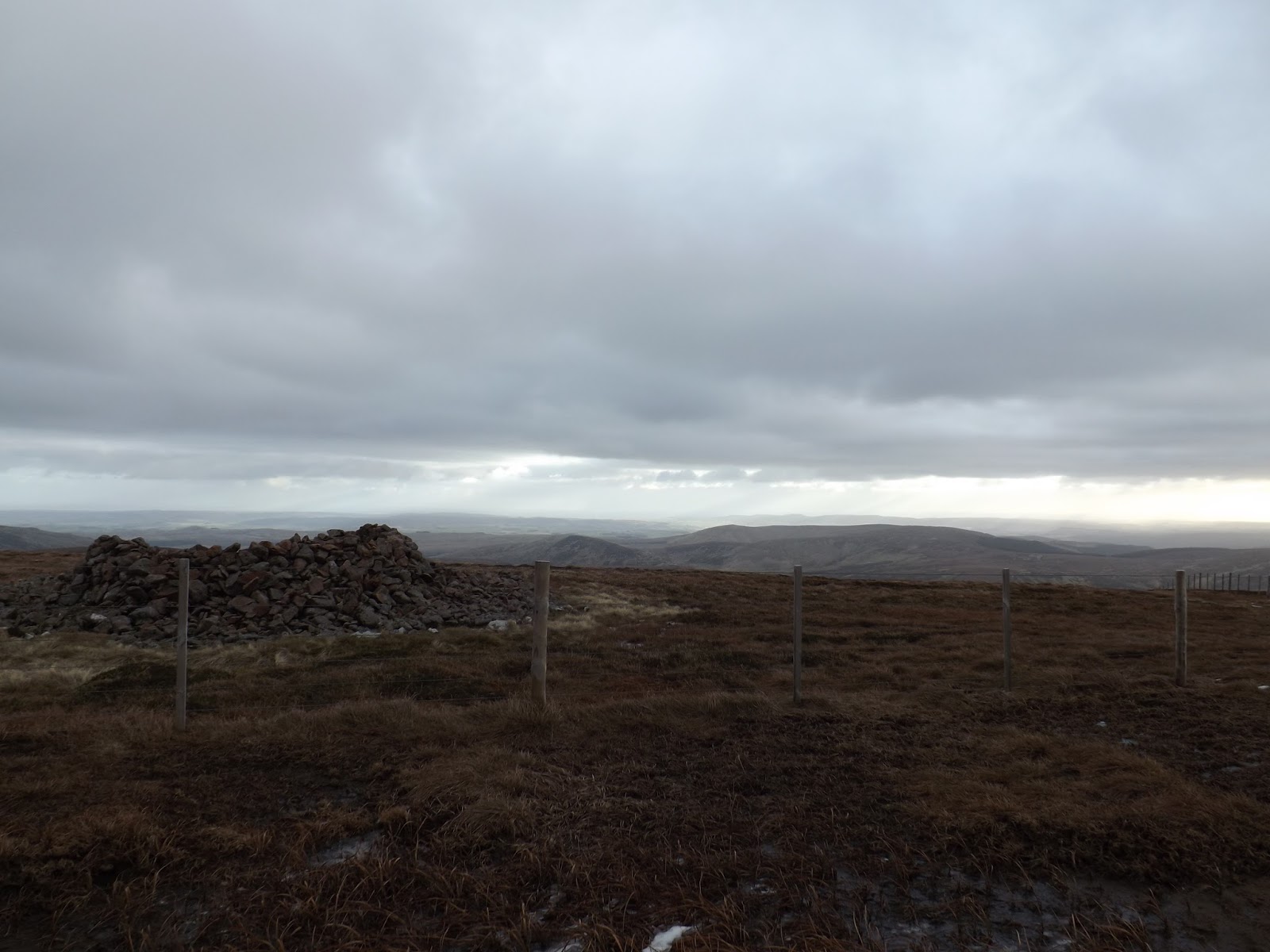
On the last part of the climb, just before The Cheviot came into view a few parts of the path were sheets of solid ice stretching far into the bogs on each side, so extra care was needed. I reached The Cheviot trig point (815m) which had stayed amazingly cloud clear.
The Cheviot trig point has been repaired since my last walk in August. A new concrete base, all the stones reset and the trig point stone mended. Really good work, thank you to those who did this work.
While having a hot cup of tea from my new flask, and a sandwich I was joined by a couple, who had walked up from Langleeford. The only people I had seen on my walk. After a few minutes they walked on west and were going back to their car along the footpath south from Cairn Hill.

Once I had finished my tea and sandwich, I set off returning by the same route I had come in on.


In places where there are no stones, the ground was solid, no give at all. In places I had to take care as the grass was like glass, so slippery. It was along here I noticed that I could not get any water from my Camelbak as the water in the drinking straw had frozen.
I saw King Seat trig point (531m) on my return journey.

A little lower down the hill the temperature had risen a little and in places the ice had melted a little and water was now lying on ice, making it slippery and I had to be careful. On reaching the footpath junction towards Wedder's Leap I turned left and started heading down hill.

In places what had been solid ground on my walk up was now muddy and slippery on my way down. It was really quite warm compared to my walk up. Even the water in my Camelbak had defrosted.

At the bottom of Hazely Law, I crossed the track to walk the eastern side of The Middle. I could see the area of wood that had been harvested on Middle Hill.

Dropping down from The Middle, through the gate and up the forest track on Middle Hill. Turn right along the footpath, along another forest track, then turn left for a short step through the trees to reach the track that runs up to the gate on the south edge of the wood.
In the open follow the path up a short rise before dropping down to the stream.

Follow the stream a few hundred meters before climbing up beside the small wood. Then follow the path down to Barrowburn.

A left, south along the wall and a right, west over the field and footbridge back to Wedder's Leap and the car park.

A great day walking, cold but dry I had covered 26 km with 710m climb.
More to follow
Boz North
Details correct at time of walking.
If you have enjoyed reading my walk or found it useful you may also like to read other walks I have done in Northumberland or other areas. Please check out the links on the right hand side.
No comments:
Post a Comment