Thursday, 5 October 2017

The Battlements of Valletta - Malta 22 Sept 2017

The Battlements of Valletta
Malta
Distance 8.5km Climb 125m
Friday 22 September 2017


Malta - What a brilliant place, made all the better as I had a copy of a booklet titled Malta 10 Great Walks and I used this as our guide. If you are interested in obtaining a copy please follow the link Malta 10 Great Walks. Today we would be doing a walk close to Walk 1, The Battlements of Valletta. What a find, although small the booklet gives a good description of routes and points out loads of interesting information. I feel it would be wrong of me to include all the historical and interesting information from the booklet on my blog so I am only writing of the walk we took. I would recommend this booklet to anyone interested in doing this walk.

We took the number 42 bus to Valletta from the hotel and started the walk from the bus concourse. We could see that a lot of work was going on as we moved towards the City. I took loads of photos, too many to include here, so I have had to unfortunately leave a load of good photos out.


We saw Freedom Square.


Where we stopped for an iced coffee at the Cafe Royale, before turning left down Ordnance Street.


Turning left again up into Hastings Gardens. We could see many of the points mentioned in the booklet. Walking right through the Gardens.


Turning right as we left the Gardens we passed what is left of a 70 foot column.


We saw a number of small chimneys, from small houses built on the side as the road drops down.


Dropping down we passed the jetty for the Sliema ferry and continued by the water.

I noticed a few weeks ago on my walk to Dunstanburgh Castle that the old castle and area around it was brought back into service as a defensive position, a lookout, during the Second World War. Valletta and many parts of Malta are the same. They may have been built by the Knight as strongholds, early warning systems in the 1500's, but the same places were reused as strongholds, places of early warning 300-400 years later. I think this is amazing, I will be honest for some reason I did not think these places would have been used in modern warfare.  


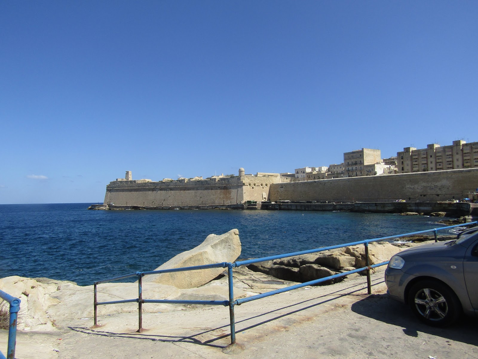
As we followed the road round the coast we were following the high walls.

A quick look at the narrow streets through the Jew's Sally Port.


Then we returned back to the path round the outside of the walls.


Passing the iron bridge in front of the Fort of St Elmo, we were now on the side of the Grand Harbour.


The booklet now says this part of the walk becomes quite exciting, and it was, it was brilliant.


Reaching a quay we took the steps up to a walkway that led to steps that took us to the road.


Opposite the Mediterranean Conference Centre.


Following the coastal road we reached the World War Siege Memorial.


I got a little confused with the directions in the booklet, leaving the Memorial. So we had a little bit of up and down, before I read it properly and we walked back up the road to the Lower Barraka Garden. No space for the photo of the Greek style mausoleum. After a short break in the Lower Barraka Garden we continued along the wall of the upper coast road.


Over the Victoria Gate.


Passed the British Hotel and up the path into the Upper Barrakka Garden.


Looking across the Grand Harbour we could see the Three Cities and the Fort St Angelo, we would be walking here later in the holiday. After a short wait we caught the firing of the 4 o'clock gun.


Leaving the Upper Barrakka Gardens we were in the square near the Prime Minister's Office.


Turning right, we were now leaving Valletta and entering the town of Floriana, walking down the low road on our left, a turn right and climb up a street brought us to Triq Saint Anna (St Anne's Street).


We crossed the road and walked up to the Lion Fountain.


Turning right up passed the Methodist Church.


Continuing right, stopping to view the parish church of Flotiana, St Pablius.


We had a look at the square and the stone caps.


Crossing the square we walked into the Mall Garden.


Walking to the end of the park we saw the Independence Memorial with the Phoenicia Hotel in the distance.


Walking back into Valletta we passed the bus concourse where we caught the bus number 41 that would take us back to our hotel.

We had covered 8.5km with a climb of 125m. I would recommend anyone visiting Valletta to get one of these booklets and to visit all the interesting places it covers. I do not think for one minute this booklet covers everything we passed as there is so much history everywhere you look. It is wrote in an easy to read, informative but not boring, observational and humorous manner, I found it excellent. 

As I said at the top, I feel it would be wrong to include the historical and interesting information from the booklet on my blog, so I have only wrote the route of our walk.

Although we were tired we were looking forward to do another walk from the Malta 10 Great Walks booklet.

More to follow


Boz North
Details correct at time of walking.
If you have enjoyed reading my walk or found it useful you may also like to read other walks I have done in Malta or other areas. Please check out the links on the right hand side.

Link to previous walk in Malta. St Agatha's Tower (The Red Tower) 20 Sept 2017


Wednesday, 4 October 2017

Boz North's Trail International Walks - Poland - Index and Links

If you have enjoyed reading my walk in Poland and found it useful. Then please do share with your friends and family. 

I have not shown the post in geographical order but with the latest walk to the top of the list.


St Agatha's Tower (The Red Tower), Mellieha - Malta 20 Sept 2017

St Agatha's Tower (The Red Tower)
Mellieha
Malta
Distance 9km Climb 280m
Wednesday 20 September 2017


I was not going to write this walk up but as I found it really interesting I have decided to included it. Today was just going to be a short walk around the area where we were staying to get a little geography of the place.

We left the hotel and walked west to the main road that runs from Mellieha to Cirkewwa Ferry Terminal. It was very warm and sunny. Warmer than we were used too, not to worry we had sun cream, hats and sunglasses.


Walking by the side of the road uphill, northwards, we turned left, west, when we reached the roundabout. The road along here is narrow and twists its way uphill, passing St Agatha's Tower also known as The Red Tower.


St Agatha's Tower only cost a few euro to go in and so we took the opportunity to visit and have a look around it was a really interesting place. The information we found in the Tower gave us a good base of knowledge for other information we were to find on our other walks round Malta. The history shows that the Knights may have built and used the Tower but it was also used in the Second World War.


It was very windy on the top of the Tower, but it gave us great views over this part of the island.


Looking north and north west we could see Comino and Gozo, island to the north of Malta. We were surprised at how close we were to these islands.


St Agatha's Tower (The Red Tower), has been fully restored and I would recommend it is well worth a visit, if you are in the area. To the north east is Ahrax Tower (The White Tower), we would be visiting this Tower later on, on our holiday.

Leaving St Agatha's Tower, we continued along the road as it climbs gently westward.


As we walked along, looking left we could see the cliffs and caves of the coast as it stretched to our south.


We would be walking this road again later in the week.


To our right, north, Anne spotted an area on Comino that looked like a bright blue bridge between the islands. Checking out the map and using binoculars we could see it was the famous Blue Lagoon, another place we would visit later on in our holiday.


Continuing on the road we could see in the distance that we were approaching a radar station.


On reaching the radar station, apparently the most western point on Malta, we turned right and followed the cliff edge along a rough path that disappeared in places, north eastwards. Looking north west we could see the cliffs on the western side of Gozo.


As we continued north east along a rough path across an area called garrigue when the Cirkewwa Ferry Terminal came into sight with Comino lying behind.


On the garrigue we saw loads of purple flowers which I believe are called ground thistles, which attracted bees and butterflies.


We found ourselves on a steep rough stony path that dropped down the side of a small valley.


That ended at a rough road, turning to our right. After a few meters we turned left off the road onto another path that continued to follow the coast line, there were a few small fields in the area. As the path continued it climbed a little and started to became rougher.


As we continued moving easterly, we lost the path and found ourselves walking by a stone wall next to a small ploughed field. Following the wall we headed towards the cliff, reaching another low wall that ran from our right to left on the top of the cliff. We could see a path on the other side of this wall. Jumping the wall and a single barbedwire fence we joined the path that took us down to Paradise Bay.


We had a short break sitting on a wall above Paradise Bay, we would be here again in a few days time. Southwards we could see St Agatha's Tower.

After our break we headed south down a narrow road, the road turned east. It dropped down a steep dip towards Wied Musa then climbs out.


On reaching the main road that runs from Cirkewwa Ferry Terminal to Mellieha we turned right, heading south. The path by the road climbs slightly. To our right we could again see St Agatha's Tower.


After the short climb the road crests the rise as it reaches the roundabout we had passed earlier on our walk. We crossed the road and headed down hill towards Mellieha from the roundabout.


It did not take us long to reach our junction and turn left.west, towards the hotel.

It had been a good walk, and we now had a good idea of the local geography. The information we had picked up at St Agatha's Tower was really interesting and we had covered 9km with a 280m climb.

We were now looking forward to more walks in Malta.

More to follow

Boz North 
Details correct at time of walking.
If you have enjoyed reading my walk or found it useful you may also like to read other walks I have done in Malta or other areas. Please check out the links on the right hand side.

Follow link to next walk in Malta The Battlements of Valletta 22 September 2017