Wednesday, 8 March 2017

PW - Dufton to High Cup Nick rtn via Murton Pike - Cumbria 7 March 2017.

Pennine Way
Dufton to High Cup Nick return via Murton Pike
Cumbria
Distance 20.8km Climb 770m
Tuesday 7 March 2017


I had seen this walk a number of months ago in a magazine but I cannot recall which magazine it was. Since completing The Pennine Way a few years ago I had always wanted to revisit High Cup Nick, today I was going to do just that. The weather was perfect.

I left the car at the car park in Dufton and walked left a few meters to take a photo of the village fountain. Returning back to pass the car park and to follow the road to the left.


As the road bends round to the right, before the Methodist Chapel I took the footpath straight ahead north east, signposted Pennine Way out of the village.


After passing the houses The Pennine Way continues left, I stayed on the track heading north east around the eastern side of Dufton Pike. The path was very wet, almost like a river in places, muddy, slippery and I started to climb gently away from the village.


It was very warm walking today, so I decided to remove a layer of clothing. I had not expected it to be as warm as this.


After approx 2km I passed through a gate and the path continued up high, by the side of Great Rundale Beck.


Passing old mine workings, the path crosses Great Rundale Beck as it continues to climb up hill. A very steep climb for a few hundred meters.


As the path levels at the top I was at Great Rundale Tarn (670m) with its hut. It was a little cooler here.


After a cup of hot chocolate I headed south easterly over open countryside. The ground was very soft in places and I had to skirt around a number of boggy areas. Passing the 699m cairn I headed towards the 692m trig point.


I was a little sad to see the 692m trig point so damaged and the plate missing. After a couple of photos I continued south easterly along Backstone Edge. I could hear curlew calls as I moved across the open ground.


Crossing a small boulder field I stopped to walk around the Narrowgate Beacon (656m). I crossed more boulders as I continued south easterly.


Reaching a cairn I turned north east to follow along the top edge of High Cup Gill.


The views were stunning as the Gill opened up below me. I was on the high point and could see a number of other walkers moving up The Pennine Way.


I continued around the edge until I found a route down onto High Cup Plain.


Walking around High Cup Nick I stopped occasionally to take a few photos.


Wondrous.


Stunning.


Moving around the eastern side of the Gill I was now heading south west following the edge of the massive feature. It was along here I stopped for my sandwiches and another cup of hot chocolate.


After my sandwiches I continued south west along the edge.


After a small climb I crossed a stream and then climbed a style over a wall. The path I took turned south over open country heading towards Murton Pike.
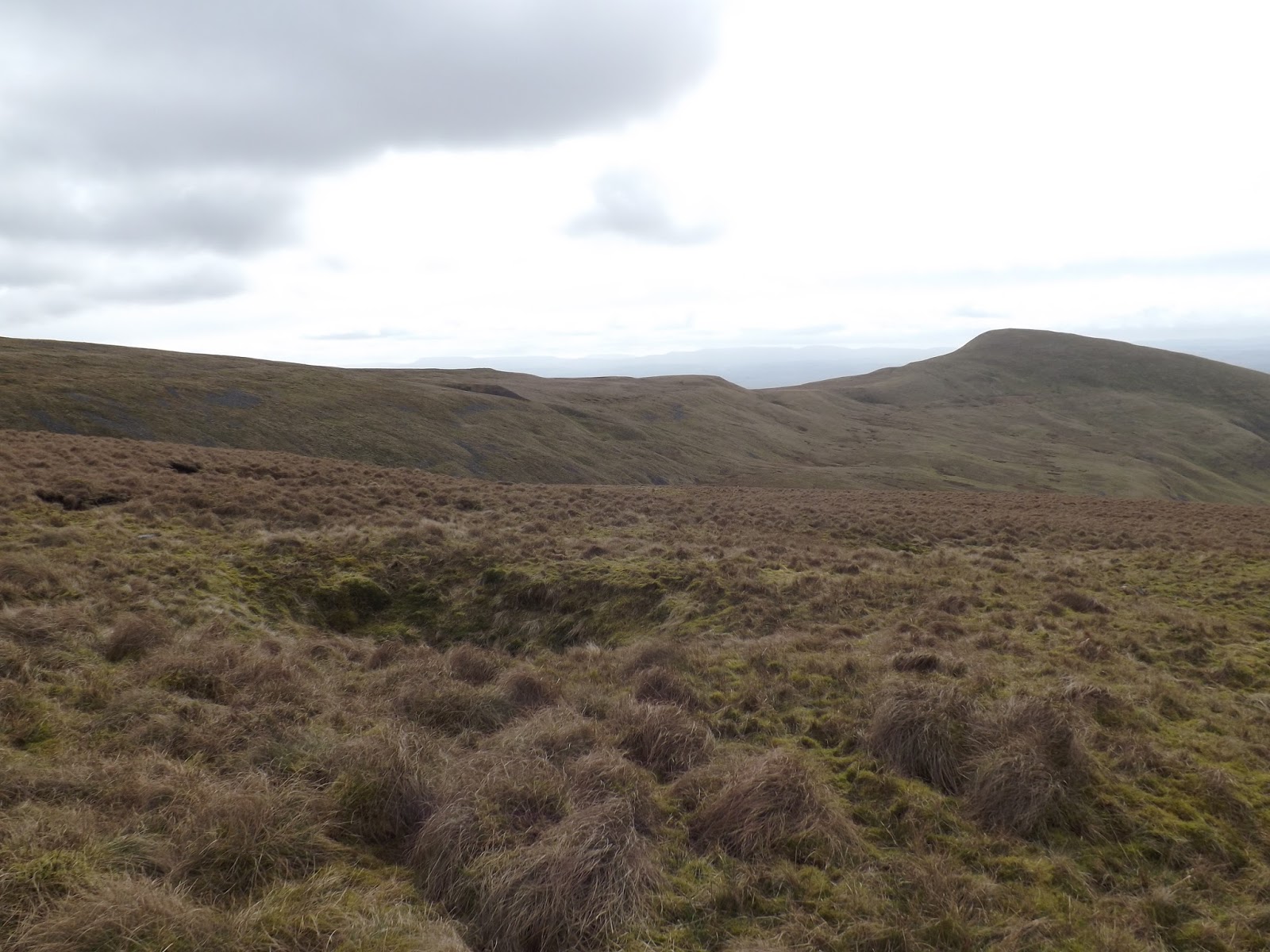

I contoured around and found I had come too far down. If I had continued on this route, there would have been a steep down hill followed by a steep up hill, so I made the decision to continue round the side of the hill and climb a little. This allowed me not lose too much height when I dropped down to cross the stream.

The area is full of shake holes, some empty, some full of water, and a few with deep patches of snow.

I had to climb down an area of boulders, climb a wall before I crossed the stream. Followed by a steady climb to enable me to contour the south west of Murton Fell for an easy approach to Murton Pike.


It was a short, very steep climb up to the trig point (594m).


Following the route from the magazine I dropped down the western side of Murton Pike. The route in the magazine shows you cross over one footpath to reach the footpath from High Cup Gill north east of Harbour Flatt. I found signs saying private, rather than crossing private land I edged to the west of Harbour Flatt looking for the footpath coming from the south. Eventually after crossing a couple of damp, very wet muddy fields I reached the track and then onto the road.

Turning right, north west I walked approx 2.5km along the road. In the distance far to the south west I could see snow on many of the hills of the Lake District.


The road was very quiet with only one car passing. Eventually I reached Dufton.


It had been a good days walking. I had covered 20.8km with a 770m climb. Very good, I will be coming back here, hopefully soon.

More to follow.


Boz North
Details correct at time of walking.
If you have enjoyed reading my walk or found it useful you may also like to read other walks I have done in Cumbria or other areas. Please check out the links on the right hand side.

Follow link to my last walk here on My Day 9 of The Pennine Way.

Friday, 3 March 2017

Weardale Way Day 1 - Bede's Cross to Worm Hill - Tyne and Wear 14 Feb 2017.

Weardale Way - Day 1
Bede's Cross to Worm Hill and return
Distance 36km Climb 410m
Tuesday 14 February 2017


This was another walk
shown on the LDWA website, the Weardale Way. This was my first part of the 124 km walk. 


It starts at Bede's Cross, Roker, Sunderland. I parked my car at the Roker car park and walked back up to Bede's Cross, following the road along the top, south. The sea was very rough and I tried to get a few photos of the sea crashing over the South Pier. I had passed Bede's Cross on the Bede's Way.  


I dropped down to Marine Walk towards the North Pier, following the path around North Dock Basin. Where I passed a load of fishermen. Continuing around the dock the route turns up from the river to come back down towards the National Glass Centre. At the top I could see across the river, waves were crashing over the far side of the Port of Sunderland.


By contrast the river was very calm, as I continued west along the riverside. Passed the National Glass Centre and the University of Sunderland towards the Wearmouth Bridge.


Today I took the steep steps up to the bridge.


Once across the bridge on the south side of the river I took the ECP path back down to the riverside and continued west under the bridges.


It was very quiet along here, the noise from the traffic on the bridge was just a distant hum, with the sound of an occasional metro.


The Sunderland Stadium of Light was directly opposite on the other bank when the foot path turned away from the river. Passing by Liebherr, onto a road. I followed the road as it dropped and climbed again, twisting and turning. A footpath led back down to the river for a short while before turning back up to the road and climbed up onto Queen Alexandra's Bridge. It was here I saw my first real sign of the Weardale Way, and it was unreadable.


There was no footpath to cross the road over the bridge, traffic was coming from all over at the roundabout so care had to be taken. Eventually getting over I was now on the road heading west towards Pallion.

There is a lot of building/road workings going on due to the new River Crossing. With no signs to guide me after crossing over the road to the Pallion Metro Station I walked down by the Pallion Retail Park. Looking for a path that I could follow by the river. I could not find one and made the decision to walk back to the main road and continue west.

Walking along European Way, through a gap in the bushes I was able to take a photo of the new bridge being built to cross the Wear.  


At the end of European Way a path dropped down to the right under the metro line, which I found was cut off. I would find myself the other side of these works on my walk back. Returning back to the junction I continued along a footpath that followed the metro line, westwards, Penshaw Monument was in the distance. Eventually I found a path under the metro line and which lead me to housing on the eastern side of South Hylton. Walking through the houses I reached the High Street, which I followed down hill, north towards the river.

Across the river was a pub painted The Shipwrights North Hylton. Once on the riverside I turned left, westwards and followed along the path. The path turned into a cinder track as it passed under the A19.


Passing a farm, the map shows I was in an area called White Heught. At the top of the cinder track passing a big house, I continued along a narrow slippery footpath.


Which after passing through a wooded area opened up beside some fields. It was interesting along here due to the number of birds in the area. I was just down the river from the Washington Wildfowl and Wetlands.


The footpath was very slippery around the fields, Penshaw Monument was almost behind me then to my left and then front left as I followed the path by the twisting river. Oyster Catchers heralded my approach along the banks of the river. Grey Herons stalked along the far bank.

After the fields and over a couple of styles, I was walking by the Wearside Golf Course. Trees covered most of the footpath and I spotted a squirrel. Again gone before I could get my camera out.


Following the river the path rose and fell and opened out a little.  After passing a stables and a few houses I approached Cox Green. I had previously passed through Cox Green on an earlier walk from Jarrow to Penshaw Monument.


From Cox Green I continued by the river and arrived at The James Steel Park and passed under the Victoria Viaduct.


Following the river I walked through Reach Wood. I could see the start of Fatfield as I looked around the bend in the river.


Passing Mount Pleasant Lake on my left I reached another turn and could see the road bridge, Station Road to the front.


Crossing the bridge I walked up the road a little, expecting to see a monument on the hill to my left. Walking up the hill I could see the markings where it had been. As a child I thought it was a monument to the famous Lambton Worm. Checking it out when I got home I have found it is the Fatfield War Memorial. The original cross was destroyed in a gale and fixed as a spike. Today the cross has been replaced and the memorial sits at the base of the hill. I sat next to it eating my sandwiches. Had I known I would have taken a photo.


After my break I returned across the Station Road bridge and retraced my steps back along the river. The day had started cold but now it was very warm, especially in the shelter of the trees down by the river.


Just passed the stables at Cox Green, while I was taking care where I was placing my feet in a patch of slippery mud, a movement caught my eye down in the waters edge. A little face looked up at me and before I could get my camera out the otter had turned and dived below the water. I stood for a few minutes hoping it would come back but it did not.


A little further on I managed to catch a photo of this little chap.


When I reached the path opposite The Shipwrights North Hylton, instead of returning the way I came I thought I would continue along to see if there was another route.


It was nice along here, I came to a riverside park and passed people rowing. At the end of the path I could see the new Wearside crossing to my front.


The path turned to a track which climbed up the side a little. After a steep climb by a fence I was at the other side of the workings, part of the new crossing I had seen from the other side earlier in the day. I had no alternative but to walk back along Claxheugh Rock by the metro line. In the end I just returned to the river and worked my way back to the underpass I had walked through earlier in the day.

Then back along the footpath to European Way.


Passed Pallion, I crossed the road passed the Queen Alexandra Bridge roundabout to walk back then down the road I had come up on. It took ages to cross but was safer than the way I had walked out. Passing the works I was dropping down passed Liebherr towards the Saltgrass pub when I saw this fountain dedicated to Philip Laing and his son James who were famous for shipbuilding on the Wear in the 18th and 19th century.


I walked back along the footpath that came out onto the river directly opposite the Sunderland football ground. Continuing eastwards turning a bend in the river to see the Wearmouth bridges.


Walking under the bridges.


Up the bank ECP path to cross the bridge, down the steep steps on the north side and back along the river.

Passing the University and National Glass Centre. I came out on the path at Roker. The wind was still blowing up the sea, fantastic impressive waves, it was cold and exposed here after the shelter and calm of walking by the river. I sat and had a cup of tea watching the sea for awhile. Then it was time for home.

I had covered approx 36km with plenty of up and down but no real climb to record.

More to follow

Boz North
Details correct at time of walking.
If you have enjoyed reading my walk or found it useful you may also like to read other walks I have done on The Weardale Way or other areas. Please check out the links on the right hand side.

Follow link to the next walk on the Weardale Way Worm Hill to Fincale Priory
Follow link to another walk from Roker to Seaham.
Follow link to a walk from South Shields to Roker.