Wendy to Bourn return to Whaddon via The Wimpole Hall
Cambridgeshire
Distance 34km Climb 650m
Saturday 10 July 2021
I had to cross a few fields to reach the start of today's walk in Wendy. Reaching Wendy I turned right onto the Wendy High Street.

I took the footpath over the road from Wendy's All Saints Churchyard towards Church Farm. At the top of the road there looks like some building work is going on, the footpath runs between the building work and Church Farm Barn.

The footpath crosses a small bridge as it enters an overgrown field. There was no footpath signs but two paths of flattened grass, I followed the flattened grass path to my right. After a few hundred meters, I soon realised I was going the wrong way. Although the weather was dry, by now my feet were wet with the dew from the long grass.
After my confusion I returned to the small bridge and took the other path of flattened grass heading north west. Following a high hedge on my right hand side I soon reached another small bridge. Which was overgrown by trees and bushes and looks like it was in need of repair.

Over this footbridge the footpath led me to the right. Through long grass, I had to crouch low to pass under some low bushes, water ran off the bushes onto my head and down my neck and back.
Walking by the edge of a wheat field, I continued along the edge, north easterly. Turning left, then left again as I followed the edge of the field all the way round. I did not realise I had missed the footpath across the field, although I had taken a photograph of it.

After my wander around the edge of the field I soon came back around to join the footpath. Where I now turned right heading north west.

As I approached the B1042 I could see my next footpath sign, it was just across the road.

Through the hedge all I could see ahead of me was nettles and prickles. And so it was. The footpath ran along the left hand side of the field and it was overgrown. I could see the gap in the hedge ahead of me.

This field was not as bad as the first for nettles. As I approached this gap I saw a muntjac, as usual it ran away before I could get my camera ready.

Entering the next field I could see Croydon ahead of me. I recognised a footpath through the wheat.

After a few hundred meters the edge of the footpath joins the edge of the field which comes in at a right angles due to an old moat. I saw the moat after I scared off a couple of ducks. The footpath now runs by the edge of a field and was overgrown with nettles and prickles.
Fortunately it is only for a few hundred meters, as the edge of the field moves left again at right angles away from the footpath. I could see the marks of a footpath as it moves across the field through the wheat.

At the top of the field the footpath passes below some bushes and trees, beside some houses and soon comes out onto Croydon High Street.
Turning right for a few meters I was heading for the footpath that ran down beside The Queen Adelaide. I had walked passed here in January 2021 when I was walking part of The Clopton Way. If you want to check it out please follow the link.

A little down the footpath a barrier bars the way, but footpath signs show this is the way. I was heading up towards Shingay Hill.

Through the barrier the footpath leads into a small wood. Where I came to a small gate. Through the gate I could see Shingay Hill ahead of me and a seat at the top of the hill. I would rest there, thinking about wringing the water out my socks and having a small snack.

After brushing off the bits of grass and sticky jack off my legs. I gave them a rub to ease the nettle stings. I had nettle stings on nettle stings. I took my boots off and found I was walking in puddles of water, in my boots.
After a small snack, wringing the water out of my socks and emptying my boots of water my feet felt a lot better. I set off again. Walking through a gate I was still climbing the footpath a little. Reaching this field of penned up horses, some were sitting with blindfolds on.

Things became a little confused, I could not see any footpath signs. The map shows it does a big S bend. I turned left and headed towards the house where I could hear people talking.
This was were I should have come out had I followed the footpath, had I seen any signs.

Back on the footpath I was glad to be on a solid track. Wading through waist high nettles, long sharp grass and prickles had taken a lot of effort. One map shows this as Church Lane.
I followed this track for about 2km, north west. It was starting to turn a little warmer.
After this junction the track I followed turned right a little and headed north easterly.

After a few hundred meters I stayed on the main track as it turned left. You can see it in this photo. The map shows the trees on the left cover another moated area.
I sometimes hear songs in my head as I walk along. Today it was "Its coming home, its coming home, football's coming home". I don't know why?

I was heading north west again. At the top of the track my map shows another large moat. I thought I could see yet another moat further to my left through the trees over an area of lovely yellow and blue wild flowers.
The footpath turns left for a few hundred meters before turning right. I could see now the embankment I thought was a moat was now on my left.

It was not a moat, it was something more modern, well a few years old at least. It was a large field, along the sides, earth and soil had been built up. The side nearest the track was open apart from a number of old hay bails preventing any access, It looked strange, why had this area been separated from the other fields?
Passed the field and through a narrow wood I was at a track junction that ran from my right to my left. I had to turn to the right for a few meters. A sign shows the track ahead was a private path. I was looking for the footpath now to my left heading north west towards Hatley Wilds.
I saw the footpath which at first I thought was another track full of nettles. Although long sharp grass in places, fortunately it was not as bad as it looked and was quite good walking.

At the top is Hatley Wilds and a small lake. I have never seen as many ducks in one place as I did here. Although I scared them on my approach they made no attempt to fly away. The photo only shows a few of them, I could hear many more to my right.

Passing Hatley Wilds the footpath becomes a track, for a short distance. To my right the fields were covered in dog daisies, blue corn flowers, I think. It all looks lovely. I also took a little time to take off my jacket, it was becoming a very warm day.
After a couple of hundred meters I turned left, following the signs onto a grass path.

This led me passed trigpoint 81m, unfortunately I could not get any closer.

At the top of the field the footpath reaches the south east corner of Hayley Wood.

Following the footpath through the edge of Hayley Wood I was now walking north.
The footpath turns into Hayley Lane. I passed the junction in the photo just to have a quick look at the dismantled railway at the top of Hayley Wood, to see if it may be a walk my friend Billy would be interested in.
After a quick look at the dismantled railway, I returned to this junction, turning and walked eastwards.

It was a grass track running to the right of a high hedge.

Overhead a small aircraft flew quite low pulling a glider behind it. As I walked into the next field the aircraft and glider circled above me again, this time a little higher.
After a few hundred meters I reached the footpath I was looking for on my left hand side. The aircraft and glider were still circling.

This footpath drops down onto the edge of a field that look like peas. Every step I took I disturbed clouds of meadow brown butterflies, who escorted me the length of the field. There were hundreds of them. I stopped to take a photo and this butterfly settled long enough but it is still not a very good photo.

After a few hundred meters the footpath is joined by a track from my left.

This turns into a farm track heading towards Copy Yard Farm.
The track turns to the right passing behind Copy Yard Farm.

The track passes below a few trees, in places it was muddy and slippery. Parts of it look like it had been made with stones placed into the ground like cobbles.
Following the track left, local signs directing the way.

Heading in an easterly direction the track starts between high hedges. After a few hundred meters I could see the buildings through gaps in the hedge, on the A1198, shown on the map as Ermine Street. The map also shows it as a place of refreshment.

Along the northern edge of Kingston Wood my map shows a feature called Oliver Cromwell's Hole. I could not see any holes, but I did see some trees on the field side of the track perhaps I should have had a closer look. Maybe next time.
Passed the trees that must have been Oliver Cromwell's Hole, large open fields of wheat lay to my left. I was now on Porter's Way.
After a few hundred meters, Porter's Way starts heading down hill. At the bottom of Porter's Way the dismantled railway I saw at the top of Hayley Wood merge together. Signs show this is all private land so I am not sure if Billy would be interested in looking at this walk.

Passed the merging of the dismantled railway, I saw a footpath gate straight across the road B1046 and so crossed over.

An information board informed me I was in the area of Kingston and Bourn Old Railway Local Nature Reserve. It was so full of nature, nature prevented me to get close and read the information board. It was nice here with all the wild flowers and insects. I found a seat that had been cleared of nature and had a short break. At one point I thought I felt rain but I soon realised it was flies buzzing my head.
After my break I turned back and headed towards my left and reached another gate that led to the B1046 but I turned right and crossed the footbridge. I would use this gate on my return journey.

Over the footbridge I was on the grass footpath that leads around the Bourn Golf Club.

It was good walking along here. Loads of wild flowers, blue corn flowers, dog daisies, lovely yellow flowers possibly cowslip and some white flowers I think may be yarrow. It was turning very warm.
The grass path climbs gently before dropping down, through a gap in the hedge I could see the steeple of St Helena and St Mary's Church in Bourn.
At a footpath junction there is a footbridge which led me into a large grass field. A couple of large Lego blocks are in place to stop people driving across.

There were a number of groups of people with dogs. They looked like dog training classes. A number of cars and vans were parked on the field to my right as I followed the tarmac path towards Manor Farm heading north west. They may have been at the dog classes.

At the junction I turned left onto Alms Hill and followed the road passed an interesting old house on my left that looks overgrown and in need of a little TLC.
Just before the road starts to climb steeply I saw another interesting looking house, with large chimney's and battlements above the front door.

Alms Hill becomes High Street as it starts to climb.
When the road levels off, at the junction with Short Street, a tree has been planted near the Bourn War Memorial. The tree was planted by Cyril Crow who was a member and chairman of the Parish Council.
I collected the Geocache near here after a short rest.

There was an Surname on the War Memorial that is not very common. It was the same as an Uncle I had who married into my Mam's family. It flashed across my mind perhaps they may have been related.
After my rest I headed down the footpath next to the Willow Tree a pub.

There are tall fences on either side and lovely roses were trying to escape over the right hand fence. At the bottom of the fence the footpath passed beside the pub garden where a large tepee was set up.
The footpath led across the large grass field where some of the dog classes were still in progress, towards the Lego block bridge. I was returning along the same route apart from a couple of changes.
As I previously said, after the grass path around the Bourn Golf Club, instead of walking fully into the Kingston and Bourn Old Railway Local Nature Reserve. I left by what was now the first gate onto the B1046. It was only a few meters along the road before I crossed and started returning along Porter's Way.
Another change I made was when I reached this footpath sign on Porter's Way just before Kingston Wood.
As I approached this junction I could see a kite flying above a field of wheat to my right. Not a kite the bird but a kite on a string acting as a bird scarcer. After trying to take a photo of the kite I turned left down this footpath.

Following the footpath over a small wooden bridge the footpath led me by a field I think were peas, what a lovely smell the flowers were giving off.
Walking slightly down hill I could see the gap in the hedge where I was headed.

Following the steps down I collected another Geocache. Over the footbridge and the footpath joined a track.

The track climbs following the eastern edge of Kingston Wood. After a few hundred meters another footpath sign pointed my route across another field in a north easterly direction.

It was while walking across this field of what I think is more peas, I met a lovely couple who told me a few things to look out for. It just remains for me to say I did not see any of the things they told me about but I did see this beautiful butterfly.

This gap in the hedge was a little overgrown.

I managed to push my way over the footbridge and into the next field. Where I turned right and headed southerly, following the edge of the field as it started to climb a little.

At the corner the footpath continues by the edge of the field heading easterly, still climbing.
Reaching the top I was now on Crane's Lane, the Harcamlow Way and The Wimpole Way. This was my first walk in the area back in November. Please follow the link and check it out, see the difference.

Passing the farm buildings there was a strong smell. I thought it may have been cattle but I don't think it is a cattle farm. Anyway I soon reached Old Wimpole Road.

Where I turned left and followed the road as it passes some holiday cottages. The road bends down to the right and starts heading down hill.
I knew from my previous walk I needed to turn right passing through these gates.

Following the big wide path for a few hundred meters I turned left and headed down this grass path by a stream towards the Folly. There were a few drops of rain but nothing to stop for.

The short climb to the Folly was fantastic.

Leaving the Folly behind I continued across The Wimpole Estate towards the Chinese Bridge.
Over the Bridge I had a short rest near the lake. Watched the swans, geese and pond skaters before setting off again.

Following the paths I headed for the Hall.

Then to the right and passing the front of the Hall.

To head down The Avenue.

Following the advice of the couple I saw earlier I headed towards the right of the Avenue. As I said I didn't see what they had suggested I look out for.
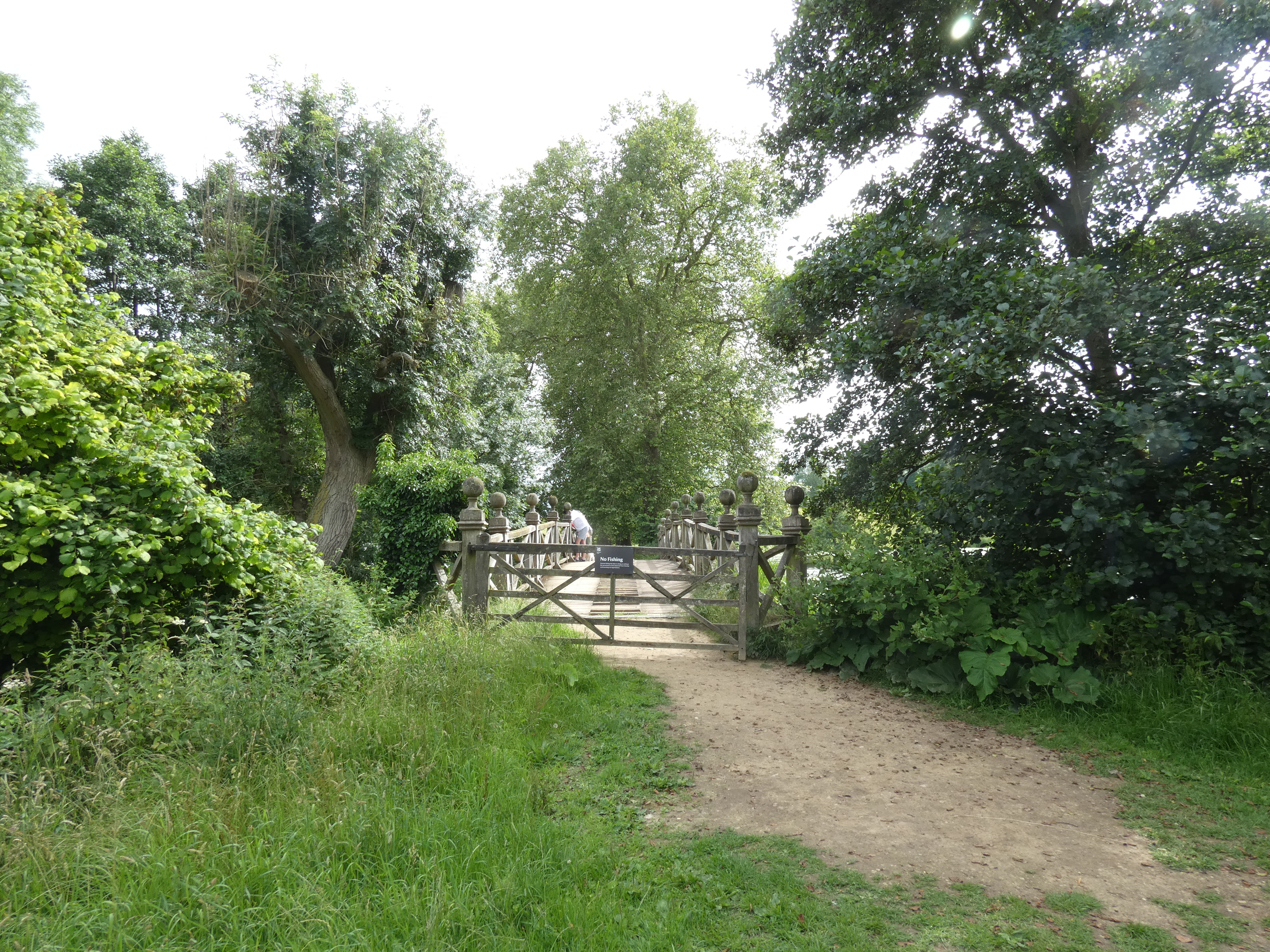
The Avenue was overgrown with tall grass and a narrow path had been trampled through the grass, marking the route. Reaching the busy A603 I crossed over and headed towards the bridge that took me over the River Cam or Rhee.

Passed the pond which was all green, normally the tall grasses look brown and dry. I continued on a few meters until I reached the footpath that leads towards Whaddon.

It did not take me long to walk the last couple of km into Whaddon.

I was very tired but pleased with my walk. The nettles, prickles and sharp grass had tried to spoil my day but had not succeeded. I have shown the distance of my walk as 34km Climb 650m. From my accommodation until my return I covered just under 41km. It had been a great day.
More to follow
Boz North
Details correct at time of writing.
If you have enjoyed reading my walk or found it useful you may also like to read other walks I have done in Cambridgeshire/Bedfordshire/Essex/Hertfordshire or other areas. Please check out the links on the right hand side.
No comments:
Post a Comment