Bassingbourn-cum-Kneesworth to Wendy via Gamlingay and Potton Wood
Cambridgeshire/Bedfordshire
Distance 41km Climb 200m
Saturday 1 May 2021
It was early and two lads were already cutting the grass around the village sign in Bassingbourn-cum-Kneesworth. As I walked westwards along the High Street.

Like a lot of the places I have seen around here Bassingbourne has some interesting looking buildings. A little further along the High Street I turned left to walk down South End.

As it says in it name I was heading almost south, passed more interesting looking buildings. I took too many photos to include them all on here.

South End continues passed the last house and has open fields on either side. Patches of hedge run down the left hand side of the road, which was dry and dusty.
At the end of South End there is a junction with Ashwell Street (Track).

I turned right onto Ashwell Street (Track). This is a long straight path.

With it being long and straight it made me think, was it a Roman Road? When I returned to my accommodation I looked into this a little further. One site refers to it as an ancient track and another shows Ashwell Street (Roman Road).

Crossing Royston Road Litlington, I continued along Ashwell Street, passed The Gingerbread House.
I had a short stop to look at an information board. This was interesting as it mentions Robin Hood and another Clunch Pit. I have passed the Clunch Pit at Orwell a few times now.
Moving along Ashwell Street I could see the Memorial I was heading towards, across the fields to my right. Reaching what is shown on the map as Allot Gdns, I did see a sign saying that it was a small nature reserve. Just passed a hedge on my right I found the track I was looking for, it was made from concrete.

Following the track right, it climbed gently northwards. After a couple of turns the Memorial came into sight. I followed the track around a large barn then up to the Memorial. I think the track may have been part of the old airfield.
Billy had brought me here a few weeks ago and I thought I would like to pass it on one of my walks.

I notice on my photo of the Steeple Morden Airfield Plan, Ashwell Street is shown as Roman Road.
After a cup of hot chocolate I set off again. In my excitement I totally misread the map and missed the footpath I was after. The footpath I was after is straight across Litlington Road from the large barn I had passed, not the Memorial.
Anyway nothing hurt only a little pride. I was soon back on my way, on the right footpath heading north. Looking down to my right was an old building which looked like it had been part of the old airfield.

After a gentle climb the footpath heads downhill and I could see across the countryside to where I was heading.

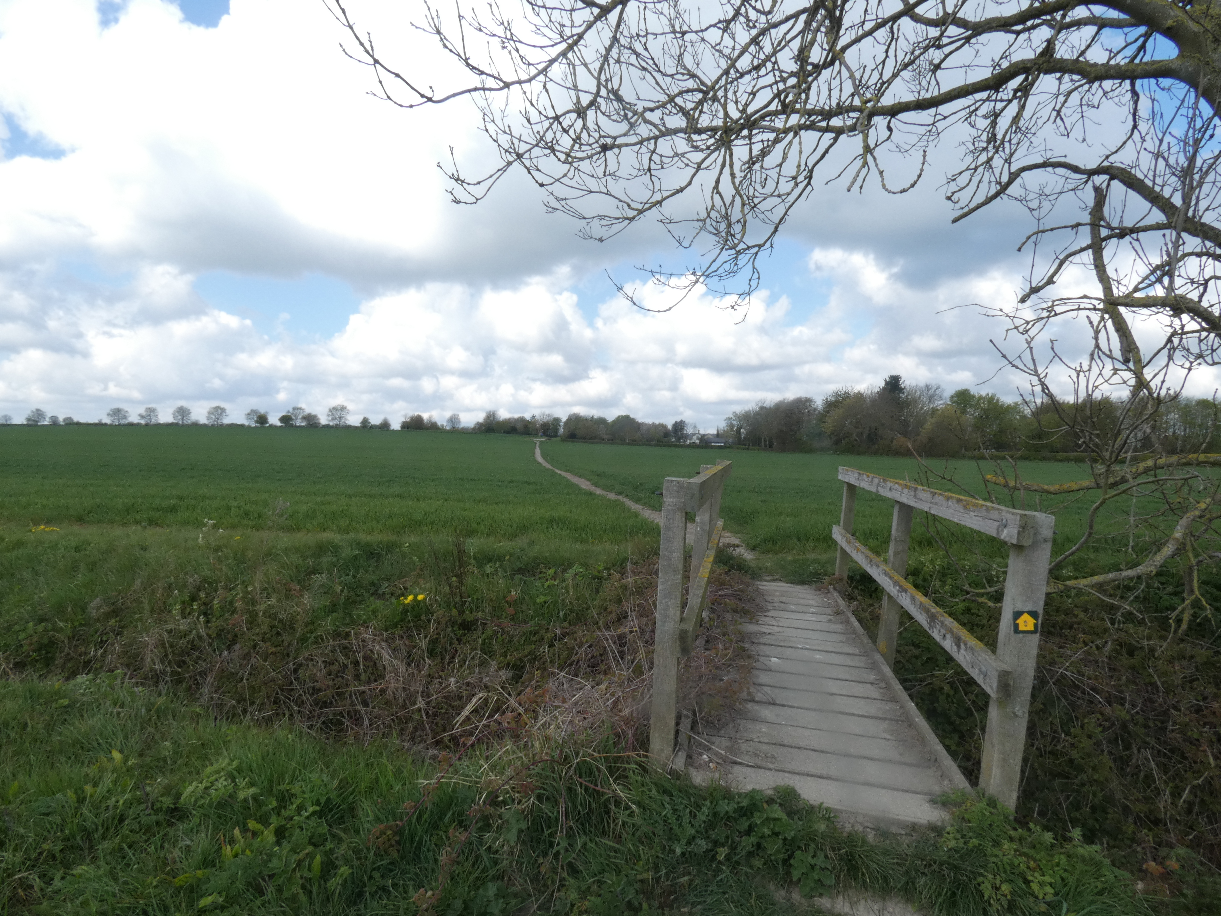
A footpath ran south east to north west across my current path, I followed this footpath left heading north west. The farmer has clearly marked the footpaths across his fields. A footbridge across Cheney Water and I collected another Geocache.

Cheney Water flows though a narrow wood, after crossing the footbridge I was walking on the righthand side of the narrow wood, west. A sign shows the wood is a Conservation Area.
My route turned right along a footpath cut across a ripe seed field.

Crossing a track I continued northwest, westerly, passed a line of trees as it drops down to a footbridge that leads over Running Ditch.

Reaching Running Ditch, another Geocache. My plan had been to continue up towards North Brook End. However as I could see that people had walked by Running Ditch I decided to continue along the side of the ditch to the next footbridge.
I had crossed this footbridge on my walk to Biggleswade in February. The walking conditions were so different now, I remember things being wet and brown not green and dry, why not follow the link to check it out.
Just before I reached the footbridge I saw the back of a sign. The sign read "No right of way". Unfortunately there was no sign to show this at the other end of the path where I had come from.
Crossing Running Ditch I walked up to North Brook End.
On North Brook End I noticed that the footpath sign had fallen over since my last walk here. On that walk I turned left, today I turned right.

About 50m passed the houses I was looking for a footpath to my left. I saw a sign post but there was no path marked on the field so I had to guess.

As it was unclear where the footpath led I had a little stumble about before eventually finding Great Green, Where The Guilden Morden Road becomes New Road. I was looking for Cobbs Lane (Tk). Cobbs Lane was a few meters down New Road on the other side of the road.

I turned right up Cobbs Lane and saw a note from Ivy, she is only 3 and loves The Gruffalo. Unfortunately I did not spot any of the animals she asked me to look out for. I may have to visit Cobbs Lane again.

Cobbs Lane heads almost directly north.

Over the Bridge the footpath continues through a narrow wood. At the end of the wood the map shows the footpath crosses the field near Tadlow Bridge Farm. There is no footpath sign however the farmer has a pathway marked across the field.

Crossing a footbridge into the next field part of the footpath has been ploughed over but beyond you can still clearly see the two footpaths. I took the one on the left.
Another footbridge and I was on Tadlow High Street.

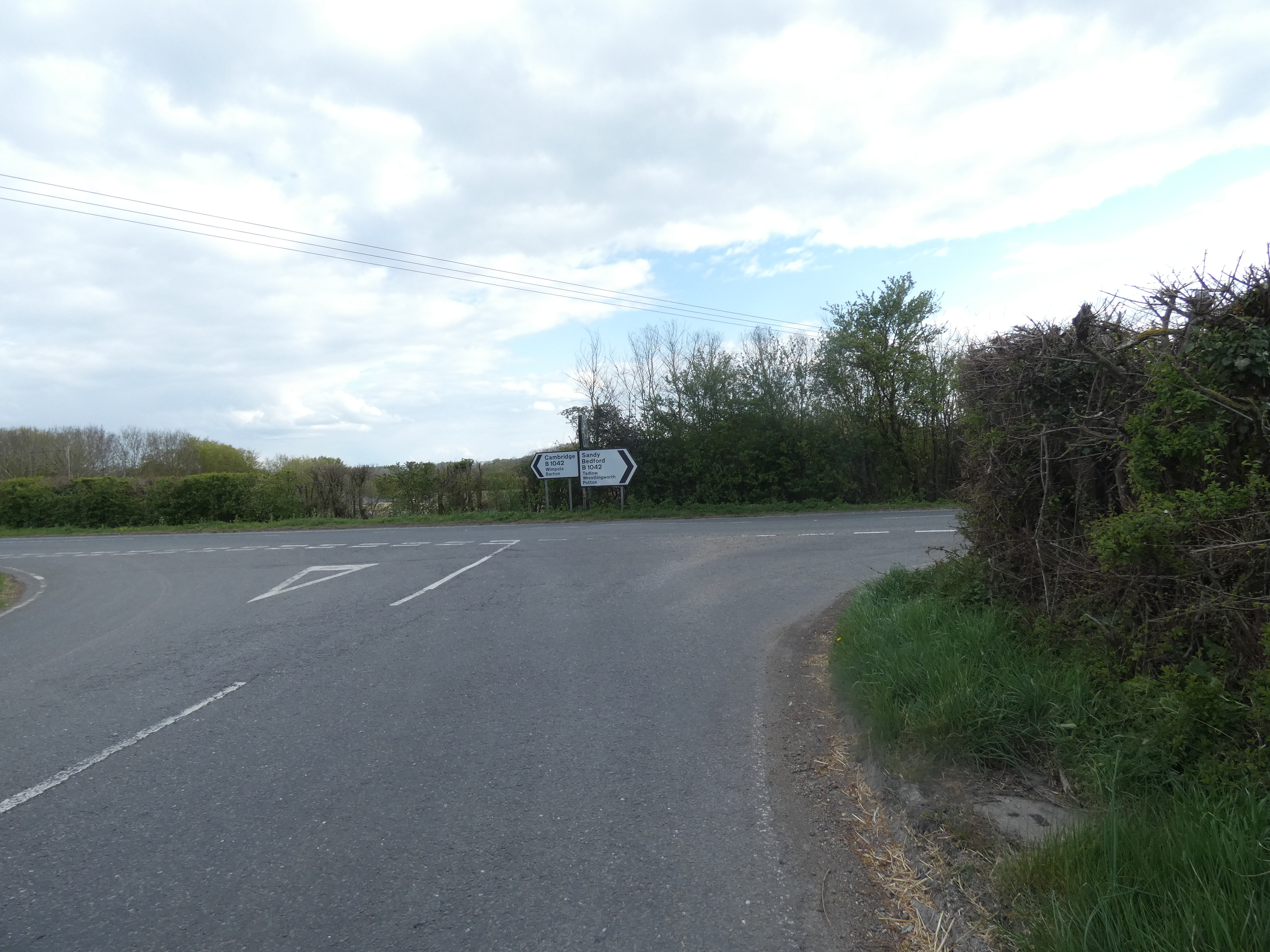
At the top of the High Street there is a junction with the B1042.

My route was the footpath straight across the junction. I followed the footpath up to St Giles Churchyard. Where I saw a seat and decided to have a short rest. A sandwich and a cup of hot chocolate.

While eating my snack I noticed two graves near each other. One could have been Father and Mother near their Son and his wife. After my snack I had a walk up to the Church, the metal gate was hanging from its hinges. Trying to read the sign from outside it looked like the Church was closed due to structural damage.
Returning to the footpath I now turned left around the outside of the Churchyard. At the corner there was three footpaths. One back down to the B1042, one up by the side of the Church grounds and the one I choose was the middle one going northerly up hill across the field. The one to the right in this photo.

Across the field and through a gap in the hedge my route followed the footpath to the left of a large hedge. At the top of this field I joined The Clopton Way. I had walked along here in January. It was so different today. Clear skies, green grass, why not follow the link to check it out and see the difference. Low mist, brown and no views.

I continued along the road to New England Farm.

Staying with The Clopton Way it continues through the
farm before turning left beside a field with horses. After a few hundred meters there is a split in the
footpaths, unfortunately no sign posts. Last time I took the first one on my right
hand side which follows to the right of a ditch. Today I crossed the ditch and continued along the other path heading north west.
I noticed last time that all the paths join up at the top of the fields.
A short right then left and I was
soon heading west. Passed Hatley Gate which is the county boundary line, I was now in Bedfordshire. Last time it was
very slippery and muddy in places, today it was so dry the ground was cracked.
The Clopton Way has a couple of turns. Today after one of the turns I could see across to Cockayne Hatley the Water Tower to the left and St John the Baptist Church to the right.

The path led me straight into Cockayne Hatley.

Walking along Village Road, I ignored the first footpath sign, I had followed this path in January and it was not the one I should have been on. Today I continued straight along Village Road until I reach The Clopton Way sign across a field towards St John the Baptist Church.

As I approached the Church, it looks like it has no roof.

When I was checking something out on Potton Woods I pulled up a website that mentions a plane taking off from Bassingbourn and crashing into Potton Woods. It also mentions a Memorial was placed in St John the Baptist Graveyard. So I had to have a look at the Memorial.

Leaving the Churchyard I walked towards the junction with Hatley Road, I was back on The Clopton Way. At the junction I turned right and
walked along Hatley Road.

Just passed the Water Tower is a
small car parking area. I continued along The Clopton Way which turns right and goes through the car park and onto a
grass track.

The last time I was here I was constantly thinking about time
and distance, worrying how far would I get and when should I turn around? Just so that I was back before it got too dark. No worries of that today, plenty of day light.
At the top of the track I turned right into the entrance to Potton Wood. Previously my friend Billy had told me that Potton Wood is known for it's Bluebells. I had come here today to see the Bluebells and I was looking forward to it. Following my previous walk here I found out that it is also a Site of Special Scientific Interest.

Into the Wood I turned right down the first woodland trail. The smell was amazing, lovely I was not sure if it was the scent of the Bluebells.

Continuing round I took so many photos. On reaching a wide track I followed this to the main central path where a viewing platform stood. This was near where I turned back on my last walk here.
I turned right and continued through the woods until I reached another viewing platform. I then turned left on another woodland trail and followed this to a path that is The Clopton Way as it leaves Potton Wood.

As I am writing up this walk I notice that I am back in Cambridgeshire. Buzzards were flying in large slow circles to my left, stunt planes were flying high circles to my far right. Gamlingay was straight ahead, as I followed the track down hill.

I passed a campsite, somewhere to possibly visit with my family. The track becomes a road.

Reaching Potton Road I turned right and headed towards the Town.

Crossing Mill Bridge I continued along Mill Street the B1040, leaving The Clopton Way. Again some interesting looking buildings.

Hidden History signs.

I turned right onto Church Road.


Right down Stocks Lane.

I found a quite place to sit and have a break and finish my sandwiches. It was nice sitting in the sunshine. It had been a funny day, weather wise, one minute hot and as soon as I took my fleece off there was a cold wind. Soon as I put my fleece on it turned warm, so fleece off, it was that kind of day.
After my break I set off on my return walk. Returning to Potton Road I was walking the same route back.
The stunt planes were making such a noise to my far left now, spinning and twisting. It was turning my stomach just watching them, how could they do it.

Reaching Potton Wood I was back in Bedfordshire.
I followed the path, then woodland trail to my right this time. I had noticed that on the north side of the Wood there was not the numbers of Bluebells there were to the south and east. Moving further west and the numbers increased with the wonderful smell.

There was also an increase in people walking along here. I also spotted a number of deer.

Leaving Potton Wood I passed the Water Tower and turned left onto Hatley Road.

Instead of turning up the footpath towards St John the Baptist's Church, I continued straight along Hatley Road. Passing the Cockayne Hatley sign. The view was so different from my last walk here, today there were clear blue sky.

After about 150m I was back on my route out and I continued along this route back into Cambridgeshire.
When I reached the footpath junction I continued back along The Clopton Way through New England Farm. The ground was so dry today.
I was finally able to get a photo of a kestrel, I had seen so many but this was the only photo that I am able to include.

At the bottom of the road, I was at the track junction, this was where I had joined The Clopton Way earlier on in my walk today. Now instead of returning through Tadlow and following my route out I was heading left further along The Clopton Way. I turned left and followed the path
on what was now the right of the hedge in the photo.

Since my last walk here it was so different. Last time I crossed a footbridge and walked by a field as it was easier than walking the muddy slippery path. Today it was easier staying to the path.
Looking up to my left I missed a small plane coming into land at Top Farm Airfield. Looking right I could see across to Royston and beyond.
The Clopton Way drops a little then climbs a little before heading into the area of the Medieval Village of Clopton. Just passed the site I sat and looked across the area. Enjoying the view with a cup of hot chocolate, I tried to identify where I had walked today.

Finishing my break I followed The Clopton Way down passed a cultivated hedge down onto Larkins Road. Turning right I left The Clopton Way and followed Larkins Road down hill.
I didn't enjoy this. It was for only about 800m but the cars were speeding up and down the road, each time I stepped off the road. It was not pleasant and took some time. A sign shows I was now leaving Croydon.
Reaching the B1042 I turned right for a few hundred meters.

I was looking for a footpath on the left, after a few hundred meters I saw the sign. Crossing the road I took the footpath which was clearly marked by cut grass, heading south. A large lake was to my left.
Over a footbridge between fields I was now in another field, with another large lake to my left. The owners had marked out the footpath with posts and it looked like they had recently cut the grass not that long before I was walking through.
Continuing south following the posts and cut grass I reached a footbridge that took me over the River Cam or Rhee. It looked a bit twisted and unstable.

On the far side the area had lots of dead old trees and the path was not clearly marked, although I could see where people had walked.

It was a little overgrown in places.

I passed the markings of a track that ran across the footpath. Continuing on the footpath through a gate, I was in an area where the grass had been cut and trees had been planted. Another footbridge took into a field full of geese who rose squawking as I approached. To my left was what is shown on my map as a Moat, it looked lovely.

More geese flew away as I approached a style, crossing the style. I was walking by the Moat. Over the Moat the map shows this was the Preceptory (Knights Hospitallers). NOTE: On returning home, Anne reminded me of the influence the Knights Hospitallers had in Malta in particular Valletta. There was nothing there today only white lines of tape used to separate horse.

I was heading back towards the track I had seen a little earlier. There were no signs showing it was a private track so I continued through the gates. More geese flew off. At one point the track disappears in the grass but I carried on easterly. I had just turned right, south when I was stopped by a man who informed me it was private land. I apologised and explained about the electric horse tape, he showed me where the track was that led to the road.
Once on the road I turned left.

It did not take me long to walk the few hundred meters into Wendy. Look at the Weeping Willow it looks stunning.


This was where I am finishing writing my walk. All I had to do now was return to my accommodation. It had been a great day walking, lots of things seen, good weather. I have only shown the walk from Bassingbourn-cum-Kneesworth to Wendy a distance of 41km with a 200m climb.
More to follow
Boz North
Details correct at time of walking.
If you have enjoyed reading my walk or found it useful you may also like to read other walks I have done in Cambridgeshire/Bedfordshire or other areas. Please check out the links on the right hand side.
No comments:
Post a Comment