Weardale Way - Day 6
Escomb to Sandy Bank Cottage NZ 136 336 and return
Co Durham
Distance 21km Climb 350m
Wednesday 27 February 2019
I had walked from Willington to Escomb a couple of weeks ago, that was my fifth part of the 124 km Weardale Way shown on the LDWA website. Today was my sixth day on the Way and I was going to walk a little further.
I was trying to walk the route by just following any signs I could see, it was an adventure and I was not too bothered where I wandered. I had looked at the route on the LDWA website so roughly had an idea where I would be heading.
I left my car near the Saxon Church in Escomb, where I had stopped for my sandwiches on the earlier walk.

Then headed west passing the Saxon Inn looking for a footpath marked Weardale Way. It was bright and sunny although a little early morning cold hung in the air. The weather was promising a warm day, the last for awhile according to the weather forecast, so I was going to make the most of it.

Passing the houses I found a footpath that ran by some allotments. The light coming through the trees to my left was clear and beautiful, a lovely spring day.

After the allotments the path opened up and I found myself walking along the edge of open fields before moving through an area of trees. I continued west and the sun was over my left shoulder.
Out of the trees the footpath drops down below Orchard House to a small narrow stream, over a style and there was a gentle climb up through more trees. I found it lovely walking along here. The ground was still hard due to a frost but that would soon clear.
After a few hundred meters and another style there are open fields to the left and trees with a steep drop to my right. Looking over the trees there was a thin fog hanging in the air obscuring the view a little. Continuing along the footpath it joins a track. I saw a sign pointing the Weardale Way, unfortunately it was showing where I had come from not the direction I was heading.
Following the track it drops down to join another track that leads to Paradise. Although I could not see any signs I continued westward onto the road under the narrow railway bridge at Witton Park. Once through I knew from looking at the LDWA website, I needed to turn right at some point so headed up Low Queen Street passing the Methodist Chapel.

At the top of the street I continued on up the cul-de-sac, High Queen Street, thinking there may be a footpath at the top, no there wasn't, so I turned around and came back down taking the road that was now to my left. I found out later this was called New Road. At the end of New Road I saw signs that the road ahead was closed. My instinct told me that was the way to go but I took heed of the road signs and turned left along Park Road. It did not take me long to feel I was going the wrong way. I was walking uphill away from the valley, walking towards the sun.
At the top of the hill I knew I was well off my planned track. I was not worried about just wandering around, that was part of the adventure but I still felt the need to follow the Weardale Way. I decided to check my map which I had in my bag. A quick check about and I soon found where I was and a way to get me back on course. The closed road sign had thrown me and I was now on a very large detour. Never mind, I quickly established that this footpath would take me back down onto the Weardale Way.

On my way back to The Way I passed this old house. It made me think of who had lived here, why did they go and where are the families now. I often think this when I pass old run down homes. I could see one of the current occupiers at the top right hand window.

After the house the track stops and I was on a footpath once more walking by open fields. To my left I saw a field full of sheep. The next field down hill had sheep with their lambs. These where the first lambs I have seen this year, I thought some lambs looked quite big.
At the bottom of the bank I was now back on the Weardale Way and things were turning really warm so I took off my coat.

Heading west again through the trees the track soon drops down towards the River. This was more like it, this was what I was after, excellent.

Dropping down by the River the path led to a boulder field, but you could see where people had walked. I liked this, very exciting.

Crossing the boulder field and a narrow stream I later found was called Witton Row Beck. I was now on a path through a wood. It was nice, cool, sheltered and peaceful through the woods.

After a short while the path splits, I was not sure which way to go, at first I took the path on the right which after a short time led to a gate across a field. So I turned back and took what had been the left path. Stepping over a fallen log worn smooth by people crossing it this path followed the narrow Witton Row Beck I had crossed a short while earlier. The path followed by a fence along what I later found was Holme Wood. It was lovely, snowdrops were everywhere. Geese took off and flew near by it was only later when looking at the map I realised there were a number of large lakes in the area.

At the end of the path I saw this bridge and steps leading up to a track. Another sign pointing the Weardale Way, so I was going the right way. As before however it was pointing where I had come from not the direction I was going.

Never mind I was still heading west, passing Witton Castle.

The track became a little more used and I could see Witton-le-Wear over the fields standing amongst trees to my right, north. The track returned to the wood as it turns right. Over a bridge crossing Linburn Beck, water was cascading over stones splashing noisily to my left. On the right hand side the beck was quiet.
After a gentle climb the track comes to an old gatehouse, I could see ahead the narrow Witton Bridge with its black and white walls. Crossing the bridge I could see the busy A68 bridge over to my left further up The River. At the far end of Witton Bridge on the left is a number of footpath signs, including one for the Weardale Way.

Dropping down beside the bridge I identified my route over a style and followed it between the fences. Small lakes were all over the area. The path turned right slightly and I was heading northerly. At the top a sign shows the Way as it crosses over a track and heads straight up the side of a railway embankment on small steep narrow steps.

At the top of the embankment I crossed over the Weardale Railway then it was down the far side of the embankment more steep narrow steps. Then a climb up towards Witton-le-Wear.

At the top in Witton-le-Wear I could not see any signs as to which way to go. I knew I had to cross the A68 so turned left, and headed west.
Again on the A68 I could not see any signs so I walked up and down the west side of the busy road. After spending some time wandering up and down I decided to check the map.

There are a number of houses on a narrow road, just off the A68. I found the footpath by turning towards the left hand houses on what looks like a private road. Then at the end I turned to the right where I saw a small footpath sign leading between a couple of houses into a field.

Walking north by the edge of the field, down hill slightly. I reached a gate, I could see the next style across the field.

Then another as The Way contoured around the fields below houses on the right.
A steep climb up over a style and I was on the farm track to High Garth Farm. The Way turns right up the farm track before turning off the track and heading north again to travel behind High Garth Farm. In places the path was narrow and prickles pulled at my clothes.
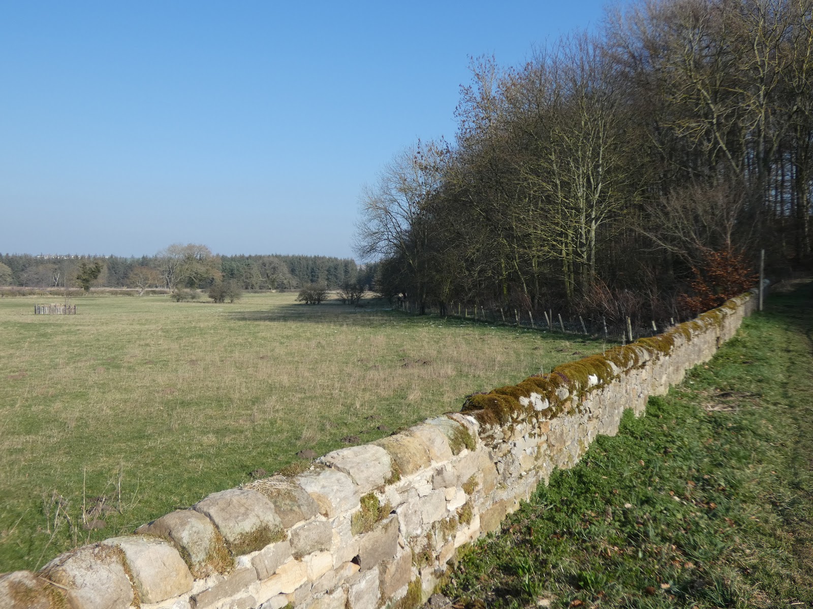
Once passed High Garth Farm and over another style The Way heads along the edge of a couple of fields. Heading towards a farm called Mc Neil. Just before Mc Neil The Way moves across a field and a style onto the Mc Neil farm track. Over the track The Way heads through a bright red gate. I headed towards another red gate on my way to a small wood, Sandy Bank Wood, at the top of the hill.
At the top I could see across to Wadley where I was headed next but I was concerned time was a little telling, especially if I have to walk the massive detour to avoid the closed road on my way back.

So I headed away from the Weardale Way along a footpath to my right, east, towards the A68. On my way I am sure I saw a fox, it was only when it ran I spotted it. It ran towards the cottage then down the track. It was so fast I didn't have time to get my camera out.
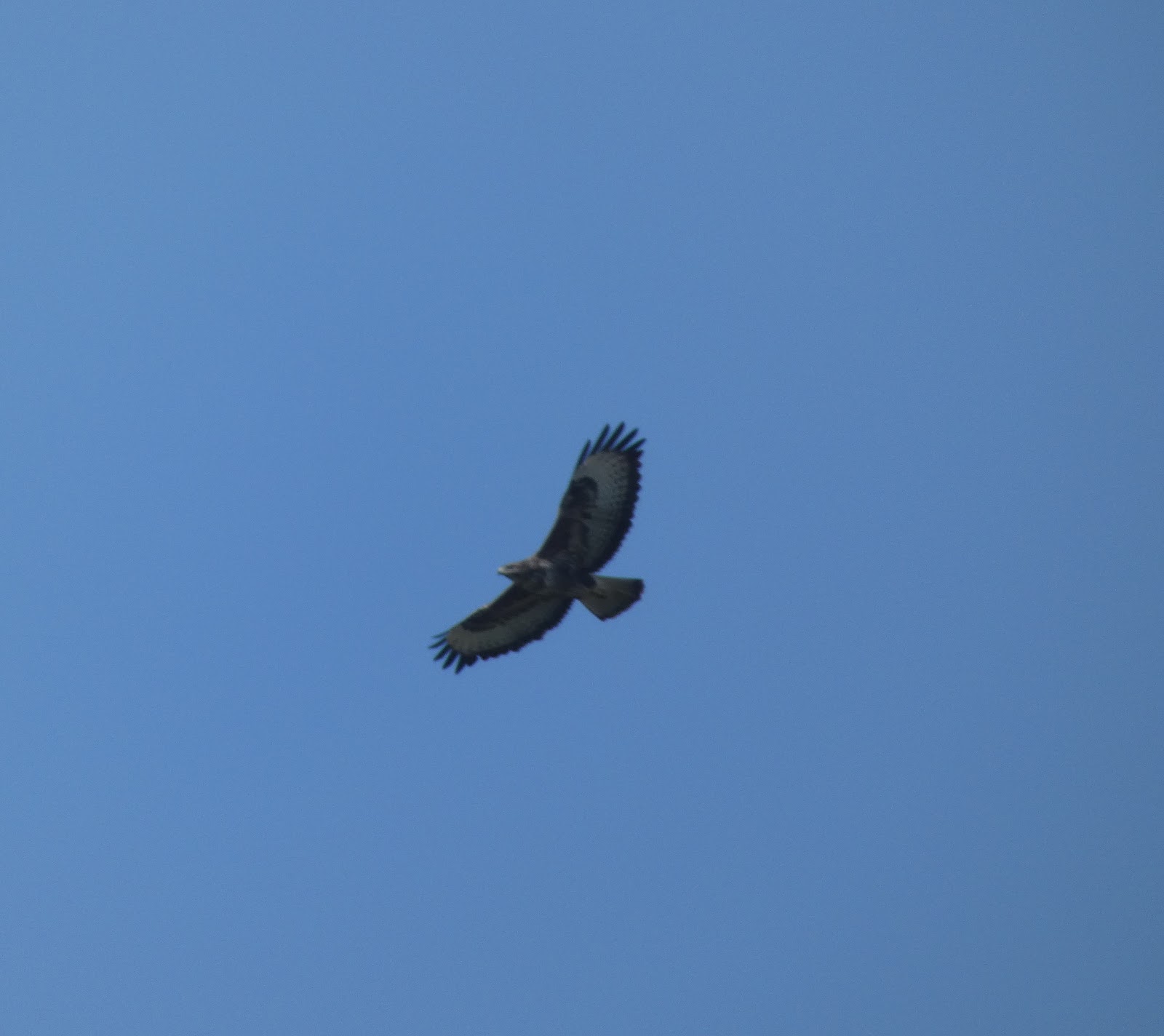
I found a nice place near the fence just before the cottage to stop for my jam sandwiches and hot chocolate. While I was sitting there enjoying the view I heard a cry and was fortunate to catch this photo.

After my break I had a walk up to the A68 passed the cottage, to see if I could find a place to park my car for my next slice of Weardale Way.
Returning back to the cottage I headed back along the path I had walked in on, looking down onto Mc Neil from the north.

I returned back across the fields, I noticed as I contoured across the fields the houses which were now up to my left all had sun rooms and large wide windows. They would all have had fantastic views across the Wear Valley.
The walk back was easier as I now knew the route but I also spotted a number of Weardale Way signs showing this way, rather than the route I had walked out on.
Crossing the A68 then taking the road up to Witton-le-Wear. Down the footpath to the right.

Up and over the railway embankment and Weardale Railway line. Passed the area of small lakes to Witton Bridge.

Over Witton Bridge and through the gate, passing North Lodge.

Over the Linburn Beck, passing below Witton Castle and down onto the footpath that runs along the edge of Holme Wood.

Over the fallen log.

Over the small boulder field.

Then up through the trees to where I had re-joined The Way. Decision time? Should I go the way I had come, (which was the path to the right), or should I have a look where the road was closed, (the path straight ahead). I had time if I needed to come back and take my detour. I took the path straight ahead.
Coming out of the trees there seemed to be a very quick change in the light as suddenly the shadows appeared longer.

After crossing a few fields I was back at the closed road. I should have gone with my instinct earlier and walked passed the road closed sign, I didn't so never mind.

I was on New Road Witton Park, I turned left down Low Queen Street where I had walked earlier in the day, passed the Methodist Chapel. Turning left to walk under the narrow railway bridge.

Following the track I had walked earlier with the Weardale sign directing me the right way. I soon came to the area of trees, it was very quite, I could not hear a sound, not even a bird. It was very quite and peaceful. Walking below Orchard House, I eventually came to the rise where I could see Bishop Auckland ahead with Escomb just below me, with it Saxon Church in the centre of the houses.

I was tired now, the closed road and long detour had added to the walk but that was what it was all about, all part of the adventure. It had been a lovely warm day. I had covered over 21km with 350m climb. I am looking forward to my next part of The Weardale Way.
More to follow
Boz North
Details correct at time of walking.
I left my car near the Saxon Church in Escomb, where I had stopped for my sandwiches on the earlier walk.

Then headed west passing the Saxon Inn looking for a footpath marked Weardale Way. It was bright and sunny although a little early morning cold hung in the air. The weather was promising a warm day, the last for awhile according to the weather forecast, so I was going to make the most of it.

Passing the houses I found a footpath that ran by some allotments. The light coming through the trees to my left was clear and beautiful, a lovely spring day.

After the allotments the path opened up and I found myself walking along the edge of open fields before moving through an area of trees. I continued west and the sun was over my left shoulder.
Out of the trees the footpath drops down below Orchard House to a small narrow stream, over a style and there was a gentle climb up through more trees. I found it lovely walking along here. The ground was still hard due to a frost but that would soon clear.
After a few hundred meters and another style there are open fields to the left and trees with a steep drop to my right. Looking over the trees there was a thin fog hanging in the air obscuring the view a little. Continuing along the footpath it joins a track. I saw a sign pointing the Weardale Way, unfortunately it was showing where I had come from not the direction I was heading.
Following the track it drops down to join another track that leads to Paradise. Although I could not see any signs I continued westward onto the road under the narrow railway bridge at Witton Park. Once through I knew from looking at the LDWA website, I needed to turn right at some point so headed up Low Queen Street passing the Methodist Chapel.

At the top of the street I continued on up the cul-de-sac, High Queen Street, thinking there may be a footpath at the top, no there wasn't, so I turned around and came back down taking the road that was now to my left. I found out later this was called New Road. At the end of New Road I saw signs that the road ahead was closed. My instinct told me that was the way to go but I took heed of the road signs and turned left along Park Road. It did not take me long to feel I was going the wrong way. I was walking uphill away from the valley, walking towards the sun.
At the top of the hill I knew I was well off my planned track. I was not worried about just wandering around, that was part of the adventure but I still felt the need to follow the Weardale Way. I decided to check my map which I had in my bag. A quick check about and I soon found where I was and a way to get me back on course. The closed road sign had thrown me and I was now on a very large detour. Never mind, I quickly established that this footpath would take me back down onto the Weardale Way.

On my way back to The Way I passed this old house. It made me think of who had lived here, why did they go and where are the families now. I often think this when I pass old run down homes. I could see one of the current occupiers at the top right hand window.

After the house the track stops and I was on a footpath once more walking by open fields. To my left I saw a field full of sheep. The next field down hill had sheep with their lambs. These where the first lambs I have seen this year, I thought some lambs looked quite big.
At the bottom of the bank I was now back on the Weardale Way and things were turning really warm so I took off my coat.

Heading west again through the trees the track soon drops down towards the River. This was more like it, this was what I was after, excellent.

Dropping down by the River the path led to a boulder field, but you could see where people had walked. I liked this, very exciting.

Crossing the boulder field and a narrow stream I later found was called Witton Row Beck. I was now on a path through a wood. It was nice, cool, sheltered and peaceful through the woods.

After a short while the path splits, I was not sure which way to go, at first I took the path on the right which after a short time led to a gate across a field. So I turned back and took what had been the left path. Stepping over a fallen log worn smooth by people crossing it this path followed the narrow Witton Row Beck I had crossed a short while earlier. The path followed by a fence along what I later found was Holme Wood. It was lovely, snowdrops were everywhere. Geese took off and flew near by it was only later when looking at the map I realised there were a number of large lakes in the area.

At the end of the path I saw this bridge and steps leading up to a track. Another sign pointing the Weardale Way, so I was going the right way. As before however it was pointing where I had come from not the direction I was going.

Never mind I was still heading west, passing Witton Castle.

The track became a little more used and I could see Witton-le-Wear over the fields standing amongst trees to my right, north. The track returned to the wood as it turns right. Over a bridge crossing Linburn Beck, water was cascading over stones splashing noisily to my left. On the right hand side the beck was quiet.
After a gentle climb the track comes to an old gatehouse, I could see ahead the narrow Witton Bridge with its black and white walls. Crossing the bridge I could see the busy A68 bridge over to my left further up The River. At the far end of Witton Bridge on the left is a number of footpath signs, including one for the Weardale Way.

Dropping down beside the bridge I identified my route over a style and followed it between the fences. Small lakes were all over the area. The path turned right slightly and I was heading northerly. At the top a sign shows the Way as it crosses over a track and heads straight up the side of a railway embankment on small steep narrow steps.

At the top of the embankment I crossed over the Weardale Railway then it was down the far side of the embankment more steep narrow steps. Then a climb up towards Witton-le-Wear.

At the top in Witton-le-Wear I could not see any signs as to which way to go. I knew I had to cross the A68 so turned left, and headed west.
Again on the A68 I could not see any signs so I walked up and down the west side of the busy road. After spending some time wandering up and down I decided to check the map.

There are a number of houses on a narrow road, just off the A68. I found the footpath by turning towards the left hand houses on what looks like a private road. Then at the end I turned to the right where I saw a small footpath sign leading between a couple of houses into a field.

Walking north by the edge of the field, down hill slightly. I reached a gate, I could see the next style across the field.

Then another as The Way contoured around the fields below houses on the right.
A steep climb up over a style and I was on the farm track to High Garth Farm. The Way turns right up the farm track before turning off the track and heading north again to travel behind High Garth Farm. In places the path was narrow and prickles pulled at my clothes.
Once passed High Garth Farm and over another style The Way heads along the edge of a couple of fields. Heading towards a farm called Mc Neil. Just before Mc Neil The Way moves across a field and a style onto the Mc Neil farm track. Over the track The Way heads through a bright red gate. I headed towards another red gate on my way to a small wood, Sandy Bank Wood, at the top of the hill.
At the top I could see across to Wadley where I was headed next but I was concerned time was a little telling, especially if I have to walk the massive detour to avoid the closed road on my way back.

So I headed away from the Weardale Way along a footpath to my right, east, towards the A68. On my way I am sure I saw a fox, it was only when it ran I spotted it. It ran towards the cottage then down the track. It was so fast I didn't have time to get my camera out.
I found a nice place near the fence just before the cottage to stop for my jam sandwiches and hot chocolate. While I was sitting there enjoying the view I heard a cry and was fortunate to catch this photo.
After my break I had a walk up to the A68 passed the cottage, to see if I could find a place to park my car for my next slice of Weardale Way.
Returning back to the cottage I headed back along the path I had walked in on, looking down onto Mc Neil from the north.

I returned back across the fields, I noticed as I contoured across the fields the houses which were now up to my left all had sun rooms and large wide windows. They would all have had fantastic views across the Wear Valley.
The walk back was easier as I now knew the route but I also spotted a number of Weardale Way signs showing this way, rather than the route I had walked out on.
Crossing the A68 then taking the road up to Witton-le-Wear. Down the footpath to the right.

Up and over the railway embankment and Weardale Railway line. Passed the area of small lakes to Witton Bridge.

Over Witton Bridge and through the gate, passing North Lodge.

Over the Linburn Beck, passing below Witton Castle and down onto the footpath that runs along the edge of Holme Wood.
Over the fallen log.

Over the small boulder field.

Then up through the trees to where I had re-joined The Way. Decision time? Should I go the way I had come, (which was the path to the right), or should I have a look where the road was closed, (the path straight ahead). I had time if I needed to come back and take my detour. I took the path straight ahead.
Coming out of the trees there seemed to be a very quick change in the light as suddenly the shadows appeared longer.

After crossing a few fields I was back at the closed road. I should have gone with my instinct earlier and walked passed the road closed sign, I didn't so never mind.

I was on New Road Witton Park, I turned left down Low Queen Street where I had walked earlier in the day, passed the Methodist Chapel. Turning left to walk under the narrow railway bridge.

Following the track I had walked earlier with the Weardale sign directing me the right way. I soon came to the area of trees, it was very quite, I could not hear a sound, not even a bird. It was very quite and peaceful. Walking below Orchard House, I eventually came to the rise where I could see Bishop Auckland ahead with Escomb just below me, with it Saxon Church in the centre of the houses.

I was tired now, the closed road and long detour had added to the walk but that was what it was all about, all part of the adventure. It had been a lovely warm day. I had covered over 21km with 350m climb. I am looking forward to my next part of The Weardale Way.
More to follow
Boz North
Details correct at time of walking.
If you have enjoyed reading my walk or found it useful you may also like to read other walks I have done on The Weardale Way or other areas. Please check out the links on the right hand side.
Follow link to my previous walk on the Weardale Way Willington to Escomb.
Follow link to my next walk on the Weardale Way A68 (NZ 137 326) to Wolsingham
I love your photos because the majority of them look like they could be from 70 or 150 years ago except for the token car in a pic. I love that!
ReplyDeleteThanks Frank.
DeleteI was looking for anything I could find about Sandy Bank, because apparently that's where my ancestor, Matthew Cowan/Cowens/Cowins, lived :) love your photos! if I can't get there myself (I'm in the US) you have given me the next best thing, a look at the area that was probably familiar to my people 200+ years ago. -- Mary Alice
ReplyDeleteHello Mary Alice, I am sorry I have just seen your message. I am glad you like my photos. Thank you so much for your lovely comments. I am not sure if you have seen the next stage in my Weardale Way but the link is above. The A68 to Wolsingham
Delete