Monday, 25 July 2016

Scales to Blencathra via Sharp Edge return Hall's Fell - Cumbria 21 July 2016.

Scales to Blencathra via Sharp Edge return Hall's Fell 
Cumbria
Distance 8km Climb 725m
Thursday 21 July 2016


With my new friends on our SMS Course, Baz parked the bus in the car parking area west of Scales (190m) on the A66. It was going to be another warm day walking.


After checking the maps we headed east up the road towards Scales.


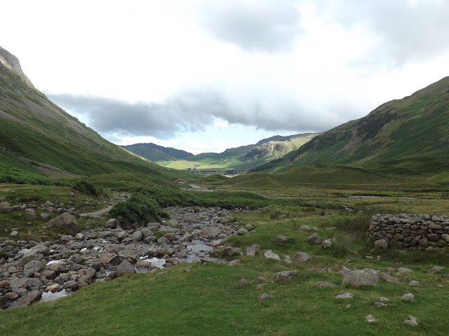
After a couple of houses we took the footpath north up onto the hill. This took us onto a narrow path that climbed northerly through high ferns almost from the start. The views opened up to our east as we climbed and I could see the A66 snaking off into the distance.


Guy was guiding us on the high path that skirted the east side of Scales Fell. We could see our fellow group of walkers on the lower path up the valley to our right, east.


Anna took over the guiding as we measured and checked our pacing over steep ground.

Baz, Anna and Shambo
Once over the steep ground the path levels off and we joined the path that ran from the east, that our fellow walkers had also taken. In the distance we could see Sharp Edge.


Starting to climb again we took the path that climbs by the stream, Scales Beck, that flows from the east side of Scales Tarn.


We had a short break on the path near the tarn to have a little snack and water before climbing Sharp Edge. It was also an opportunity to pack my camera so my hands would be free for the climb.


Once on the Edge we took turns to lead the group upward. Baz gave us advice on the best techniques and places to use this knowledge, when leading groups up this type of terrain. In what appeared to be no time at all we were all safely over Sharp Edge and Foule Crag and sitting at the top. While sitting at the top our fellow walkers joined us.


At the top Baz gave us a route to navigate to a couple of features. This led us up to the mark on the top of Blencathra (868m).


Guy, Shambo and Anna
Then it was camera away as we descended down Hall's Fell which started off steep to the south.


There had been a little cloud swirling over the edge at the top, which hid some of the views. As we climbed down, the vista opened up before us. A little way down we stopped and had a short lunch, and spent time discussing more rope safety work.


As the path levels off I got my camera out again. This was where we joined the other group, just as the path turned a little south west.


At the bottom of the path down Hall's Fell we come down the side of Gate Gill where our path joins the path that skirts the bottom of Blencathra, we turned left, east.


We crossed Doddick Gill and a steep climb to follow the path around some private land. This soon leveled off before dropping down to cross Scaley Beck. With a short climb up the other side.


We were soon back on the level following the path by a wall that took us to the gate and back down to the road near where the bus was parked just west of Scales.

We had walked approx 8km with approx 725m of climb.

More to follow


Boz North
Details correct at time of walking.
If you have enjoyed reading my walk or found it useful you may also like to read other walks I have done in Cumbria or other areas. Please check out the links on the right hand side.

Follow link to previous day walking on our SMS Course.

Sunday, 24 July 2016

Angle Tarn to Old Dungeon Ghyll via Scafell Pike - Cumbria 19 July 2016.

Angle Tarn to Old Dungeon Ghyll via Scafell Pike
Cumbria
Distance 12km Climb 650m
Tuesday 19 July 2016


Scafell Pike, number 5 shown on ITV's Britain's Favourite Walks January 2018. 

Day 2 with my new friends on our SMS Course, started bright and warm. We had our breakfast and did a little admin, such as putting on sunscreen, before setting off for the day. Starting out north west along the path from Angle Tarn (570m) to the track junction at the base of Allen Crags.

Shambo having breakfast with Baz looking on.

Anna and Guy checking the map


As yesterday Baz took time to share with us his knowledge on some of the local flora, weather and geology.


At the junction we turned south west up to the lake near Esk Hause which is nearly dried up.


Identifying a few features on the ground to map, before starting to climb west. Looking west we could see Ill Crag.


As as our route turned from west to south west we could see Great End.


Scafell Pike came into view as we walked the path north of Ill Crag, heading towards Broad Crag.


We dropped down still heading south west from Broad Crag and climbed the steep path up towards Scafell Pike (978m). There were a lot of walkers in the area. Up on the top we had time for a few photos before turning round and climbing back down.

Anna, Guy and Shambo

Shambo looking good


Once down Scafell Pike we climbed back up Broad Crag this time heading north east.


Then east down towards Esk Hause.


Back the way we had walked up, this time heading north east to the bottom of Allen Crags. Then south east along the path returning to our campsite at Angle Tarn to collect our camping gear.

Once ready we set off up to the pass to begin the long decent by Rossett Gill.


It was very warm walking down by Rossett Gill and we passed a number of groups walking up. After a brief rest to discuss a few points by the footbridge we set off again south east on the Cumbria Way.


It did not take us too long to return to the Old Dungeon Ghyll (100m) where a cool shandy had my name on it.

Excellent day we had covered approx 12km with approx 650m climb.

More to follow


Boz North
Details correct at time of walking.
If you have enjoyed reading my walk or found it useful you may also like to read other walks I have done in Cumbria or other areas. Please check out the links on the right hand side.

Follow link to Day 1 Rossett Pike
Follow link to the next walking day on our SMS Course.
Follow link to a previous walk up Scafell Pike from Wasdale Head as part of the 3 Peaks Challenge
Follow link to another walk up Scafell Pike along the Corridor Route.

Old Dungeon Ghyll to Rossett Pike - Cumbria 18 July 2016.

Old Dungeon Ghyll to Rossett Pike 
Cumbria
Distance 10.5km Climb 900m
Monday 18 July 2016


I had joined a group of new friends on a SMS Course to refresh my skills and get me back to where I want to be. Baz our guide and leader drove us to the car park at the Old Dungeon Ghyll (100m). Once we were ready us we set off walking behind the pub to join the path shown on our maps as the Cumbria Way.   


The path starts off fairly level, as we walked along it we stopped occasionally to discussed flora and basic navigation techniques. The weather although it had started very bright and sunny earlier in the day had now turned a little cloudy which was a blessing as it saved us from the sun but it was still very warm. 


We had a stop near the footbridge where there is a track junction. The Cumbria Way continues north, we were turning left, west, to start the steep climb up by Rossett Gill. Baz pointed out a number of relocation features to look out for such as the Pike of Stickle.


On our climb up the steep path we stopped a few times and discussed things relating to kit and equipment, boots and clothing. Using our maps we discussed height and tools we could use. Identified a few features on the ground. Before continuing our walk up hill. Turning round looking behind us we could see the Pike of Stickle to the left of the valley.


At the top of the pass we briefly saw another group on our SMSC who were walking in our area. They turned west as we after a short discussion turned east towards Rossett Pike.   


From the top of Rossett Pike (650m) the views were stunning. Again Baz pointed out features and valleys around us.


Turning west we returned to the pass and headed down towards Angle Tarn. Moving off the path we spent a few minutes looking for a site to pitch tents, this would be our campsite for the night.


After setting up the campsite and eating our meals we rested for a few hours before setting out to practice our night navigation skills.

Moving north then north west we followed the path as it climbed then dropped, climbed and turned before climbing again to the top of Allen Crags (785m). Baz providing advice and information as we moved in the dark. After a couple of hours practicing our navigation we returned to the campsite.

A very good day and good practice.

We had walked approx 10.5 km with approx 900m climb.

More to follow 


Boz North
Details correct at time of walking.
If you have enjoyed reading my walk or found it useful you may also like to read other walks I have done in Cumbria or other areas. Please check out the links on the right hand side.

Follow link to Day 2 Old Dungeon Ghyll via Scafell Pike